Hi,
I have lots of large raster datasets that I want to resample and save as PNG. The problem is that their rotation is wrong, and trying to modify the angle according to the image properties gives incorrect result. The images are oblique images.
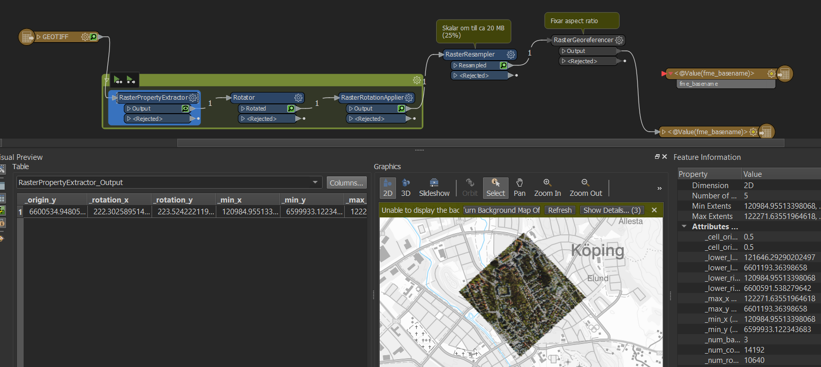
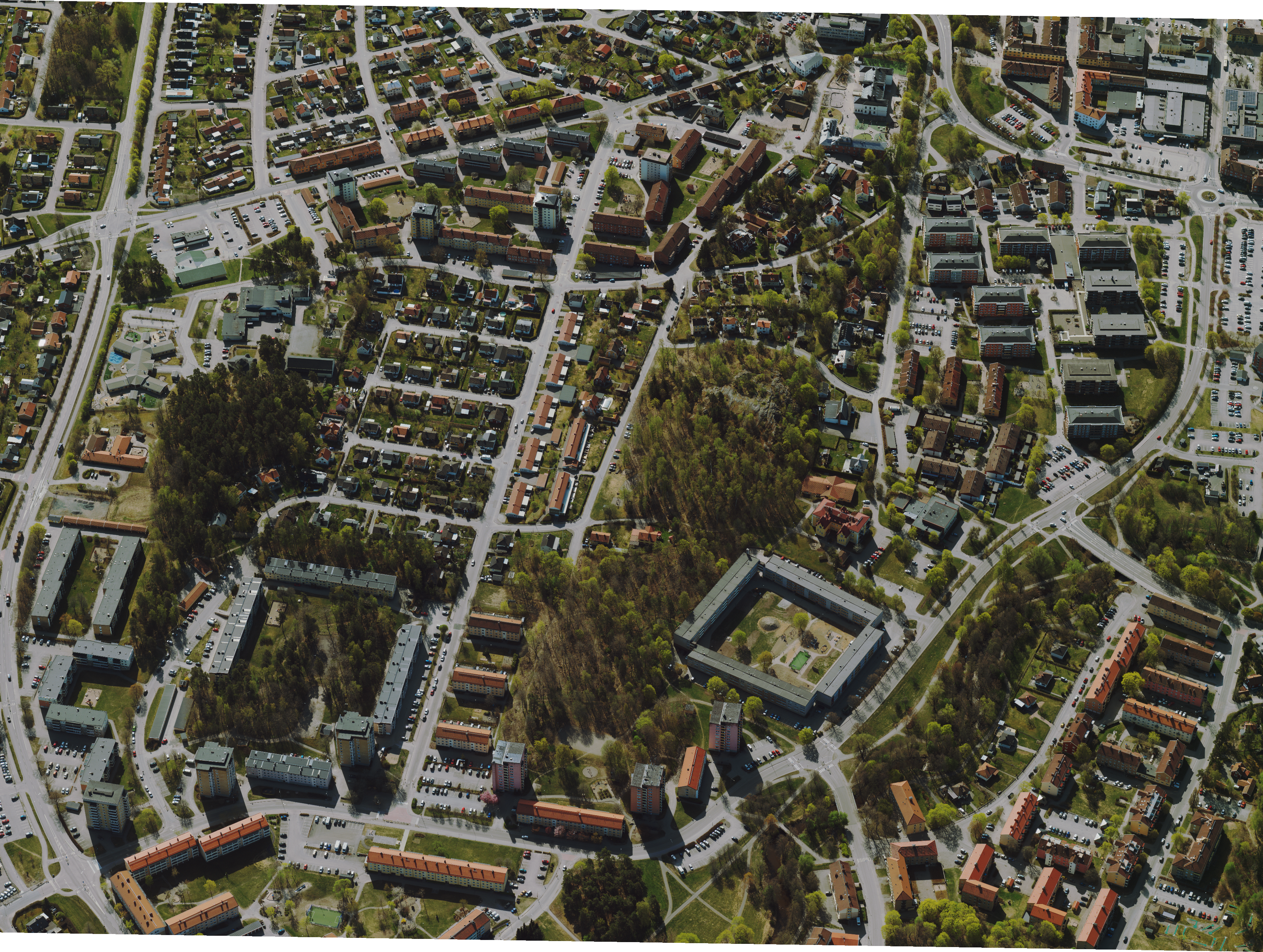
The raster in geotiff format read into FME:
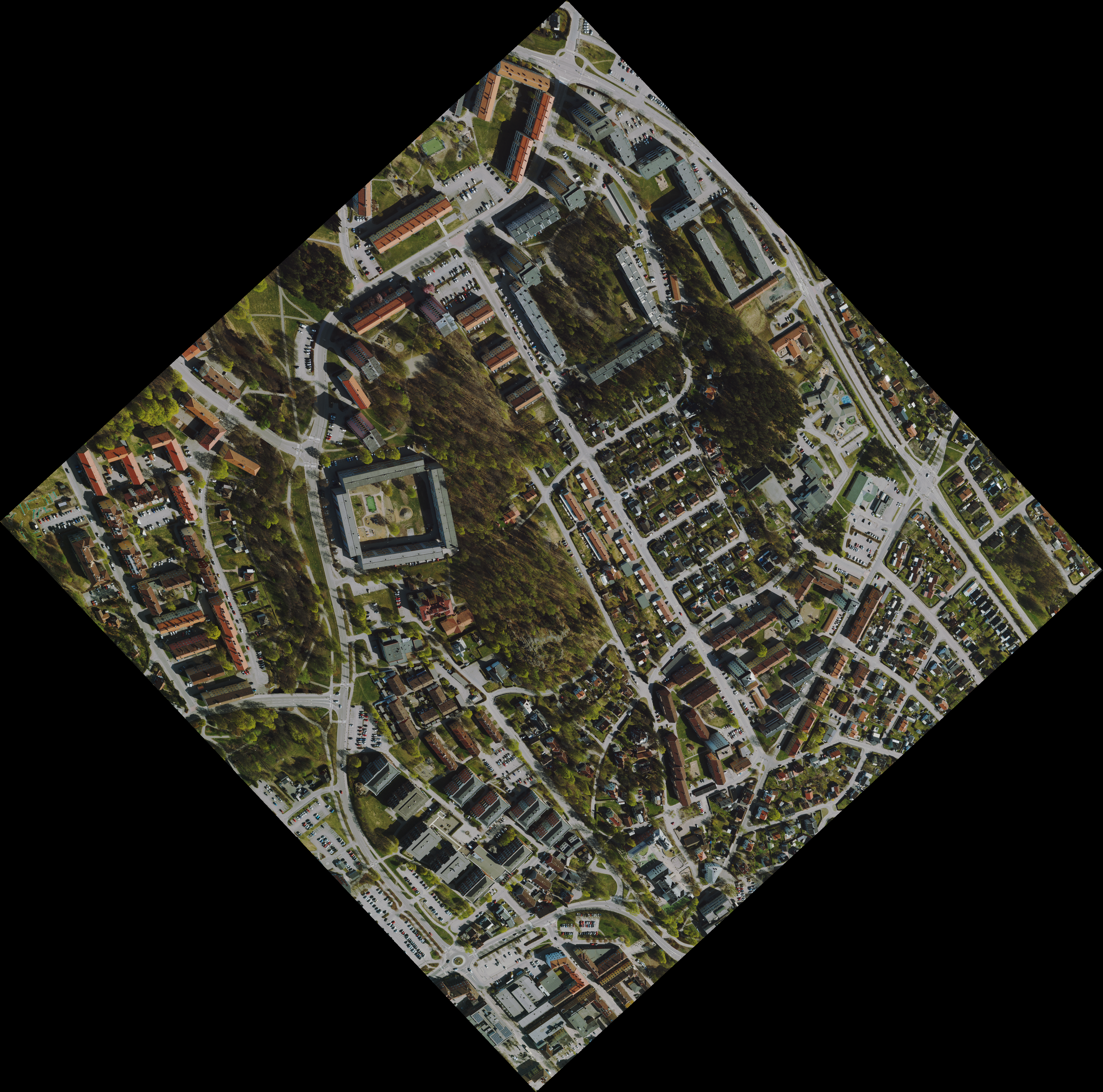
 Doing no rotation gives this result in the final png:
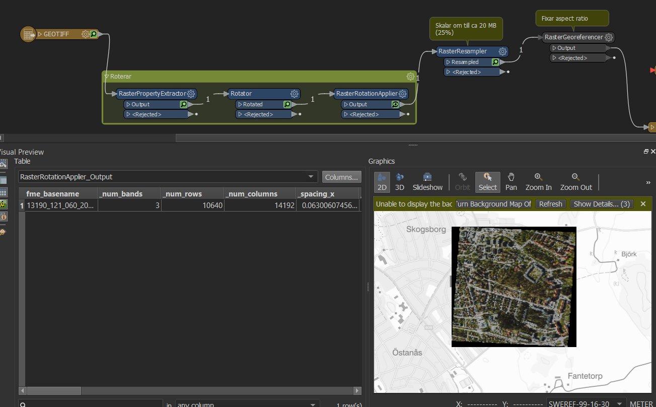
The image after rotating it.
RasterPropertyExtractor gives _rotation_x=222.30258951435636 and _rotation_y=223.52422211966618. None of these values give the desired result with a straight image.
Does anyone have any suggestions? Or is there a simpler way of doing this? Reading the image and disregarding the rotation?
Best answer by danminneyatsaf
View original


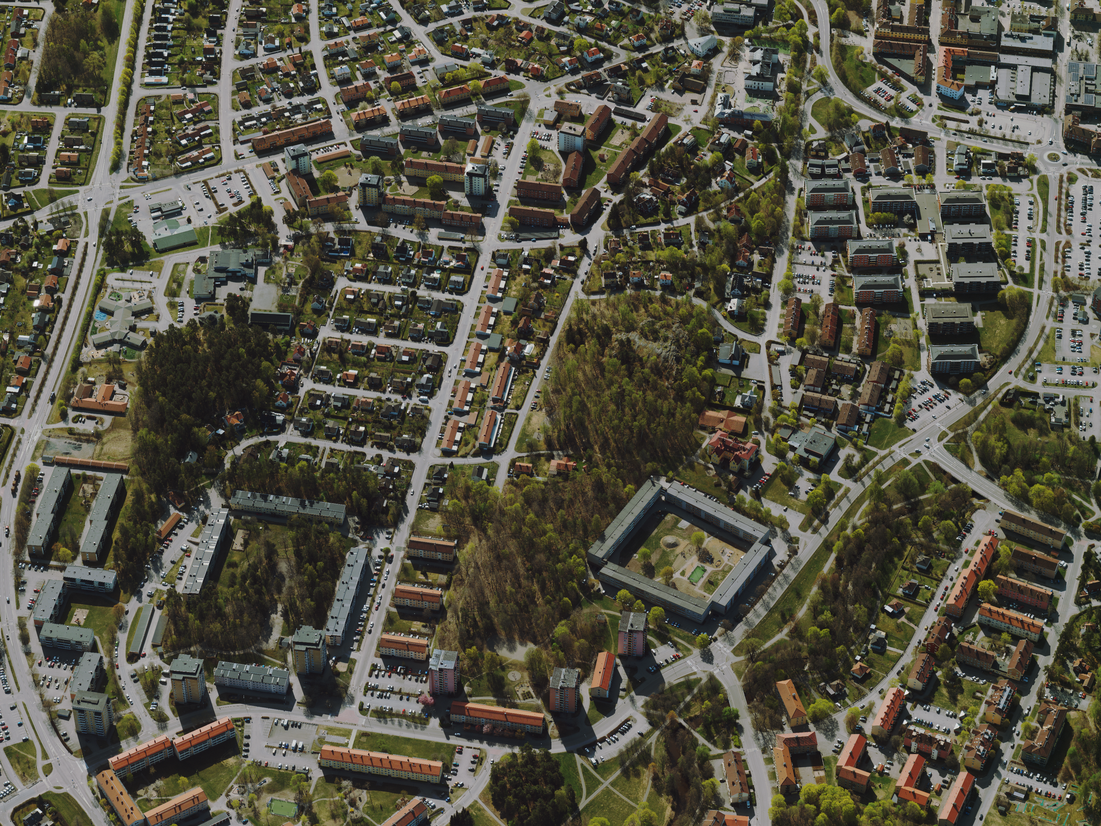
 I want FME to write the resampled image into a straight image. For example, opening the original large geotiff in windows photo viewer shows the image as I want the final result, a rectangle with 90 degree corners:
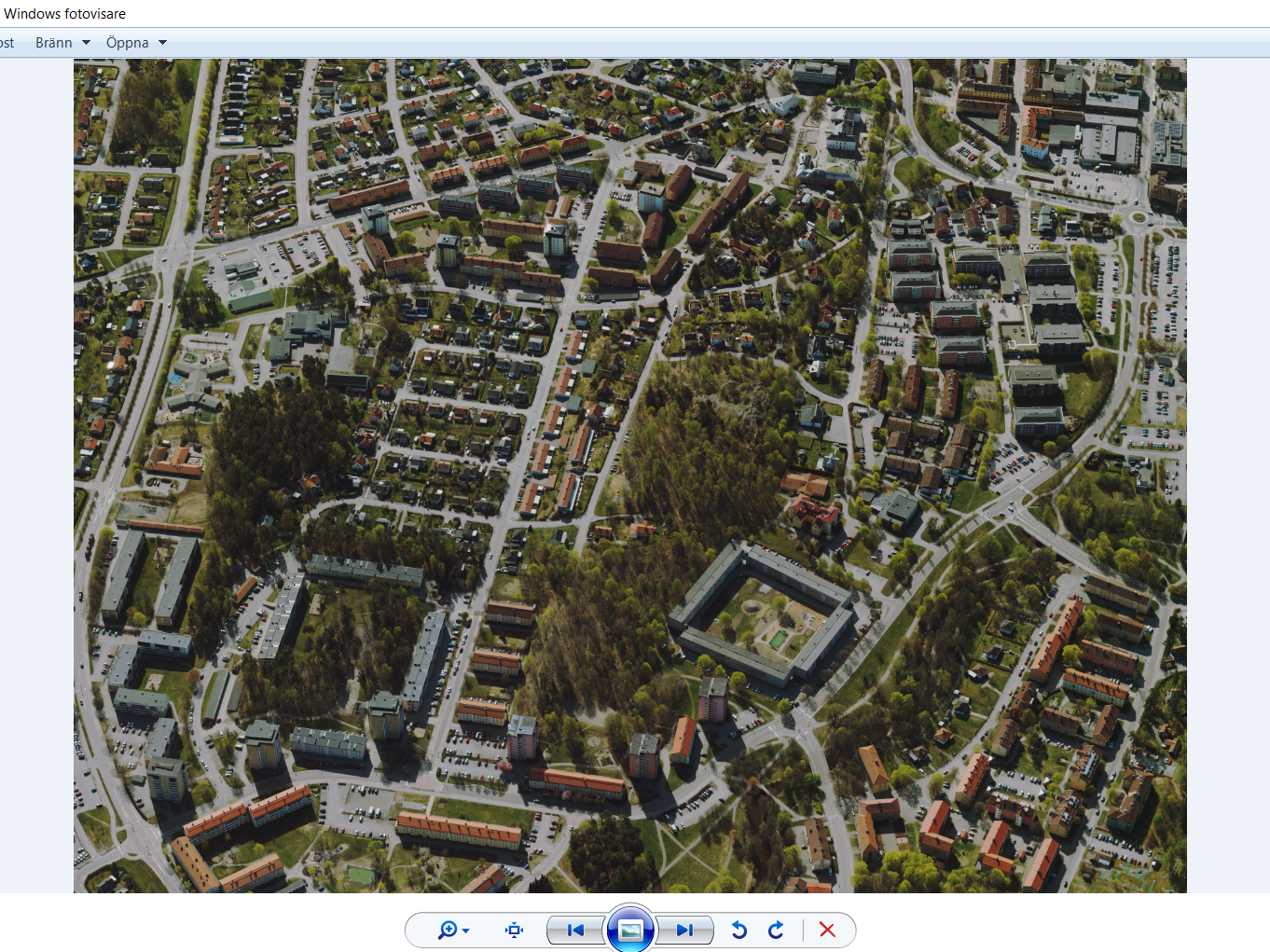


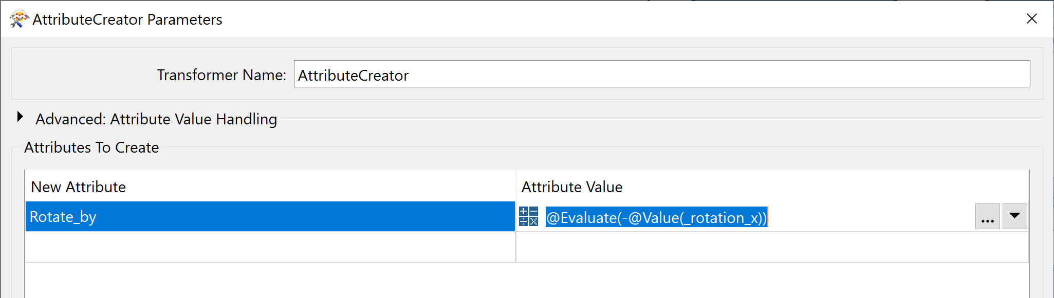 By turning the rotation value negative, we can now undo the rotation.