Solved

Read XYZ tiles

  • 25 September 2022
  • 5 replies
  • 63 views

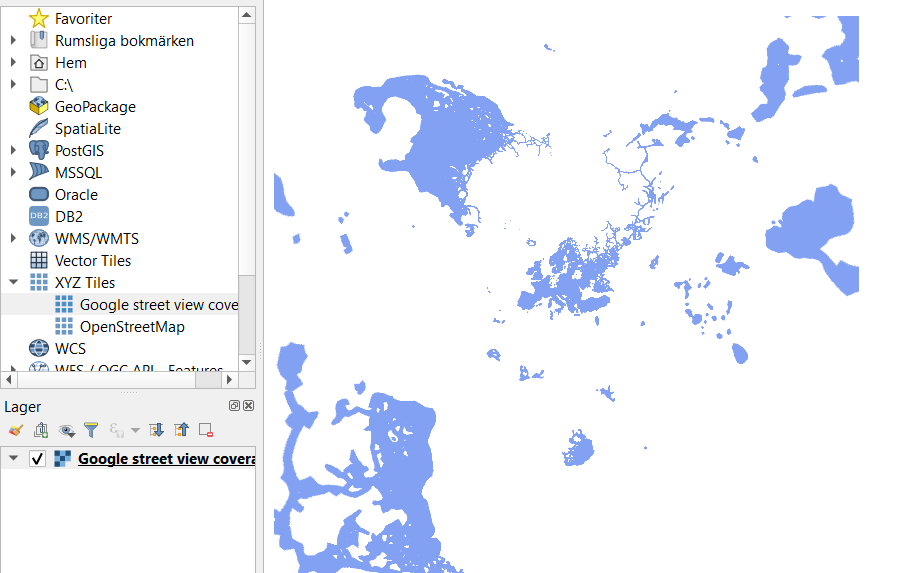
In QGIS I can open Google Street View coverage using this URL as XYZ tile:

https://mts2.google.com/mapslt?lyrs%3Dsvv%26x%3D{x}%26y%3D{y}%26z%3D{z}%26w%3D256%26h%3D256%26hl%3Den&style%3D40,18


The result is following:

image.png 

I can't get it to read into FME Desktop. Any suggestions?

icon

Best answer by natalieatsafe 29 September 2022, 16:28

View original

5 replies

Youd could try the Mapbox Vector Tile (MVT) Reader.

Youd could try the Mapbox Vector Tile (MVT) Reader.

I can't get that reader to work with my link. Did you get it to work?

"Please ensure source data is valid and correct reader is selected"

Badge +4

@leif​ Hi there, thanks for your question on accessing the Google Maps Tile server in FME. Based on our investigation of this matter, it appears that these various “mts” links are older links to the Google Maps Tile servers, and are no longer authorized access points for general user accounts. In recent years, Google began restricting access to many of its web services, including the Maps Tile servers. Please see Google’s official documentation here for more information:


https://www.google.com/url?q=https://developers.google.com/maps/documentation/tile/overview&sa=D&source=docs&ust=1664460281010053&usg=AOvVaw0ROcJGH79VvV8H-QR1GKTR


Parsing through some of the other documentation that Google provides on the Google Maps Platform (available here), you'll notice that many of the Google Maps API endpoints now require billing information and valid API keys in order to access the various web services therein.


Some of the older endpoints to the Google Maps Tile server can still be readily found online, but may be restricted unless you have appropriate permissions granted to your user account by Google. This issue is a permissions issue with the API provider, rather than an FME translation error, and is something that you would have to contact Google about if you require access to this web service.


I hope this information helps you with this issue! Please don't hesitate to reach out to the FME Community again if you require further assistance with your FME translations and / or automations!


Badge

Hi, on a slightly different topic, I have added OpenStreetMap via the 'XYZ Tiles' in QGIS. Similarly wondering if this can be added through FME. It's been a while since I've added it and the service is still working. http://a.tile.openstreetmap.org/{z}/{x}/{y}.png

Badge +4

@donegal_david​ Hi there, I had a look for the OSM tile server endpoint, and it looks like it may have changed from what you're showing. See this Wiki for more information on available OSM tile servers; the first one listed under Base Maps looks like the one you have in mind. The linked Wiki was last updated in April 2023. I would also recommend having a look at the OSM Tile Usage Policy if you plan on making use of OSM's own servers. They do have some strict guidelines that users are expected to follow while accessing their servers. I hope that gives you a good start!

Reply