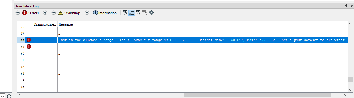
Hello, I'm experiencing difficulty transforming a .las file to Mojang Minecraft format, as I receive an error stating that the Z coordinates exceed the allowed parameters (0-255). I've found no straightforward way to manually set the maximums and minimums before transforming. I've tried to scale the .las, but the feature is imprecise and results in distorted structures. Is there a way to set minimum and maximum coordinates prior to transforming?
Best answer by danminneyatsaf
View original


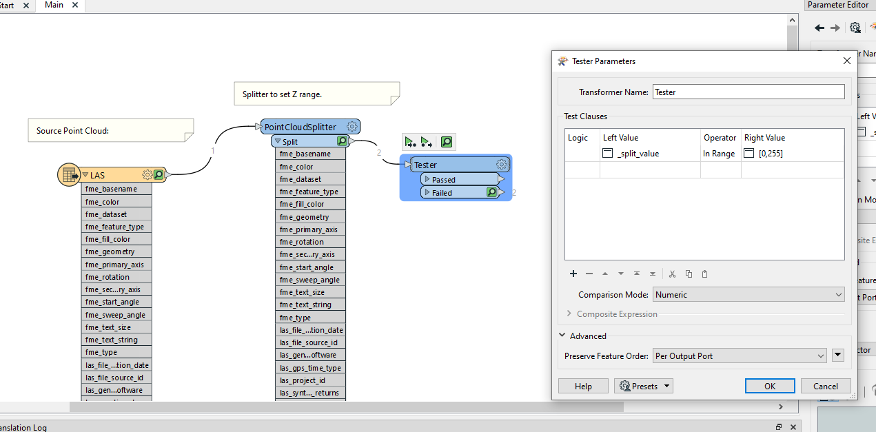
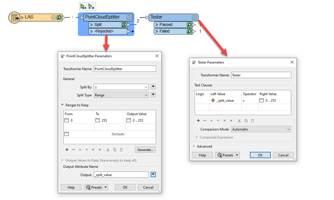
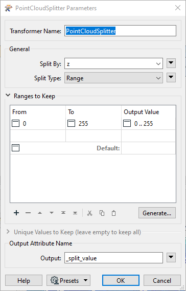 Next, use a Tester transformer to filter out only the feature that have a _split_value of 0' .. 255'.