


We recently moved some processes from Esri tools into FME. One of these has a slope calculation component. We expected to see minor differences between Esri/FME but instead we are seeing differences of up to 15 degrees difference.
Further investigation showed that by default, Esri uses a planar based algorithm. FME (and QGIS) only use a geodesic based algorithm. Esri does also have the option of using geodesic.
The original Esri process was using the default planar algorithm. When these are compared to the geodesic outputs (FME, Esri and QGIS) considerable differences are apparent. Comparing the three different geodesic outputs shows that the results are (almost) the same – as expected.
This difference has considerable ramifications for the application using these slope values. Looking at Esri documentation, it does state the geodesic is ‘more accurate’, but this doesn’t explain the 15 degree differences we’re seeing.
We have raised this question with Esri, but are wondering if anyone here has an explanation as to why such a difference is apparent?
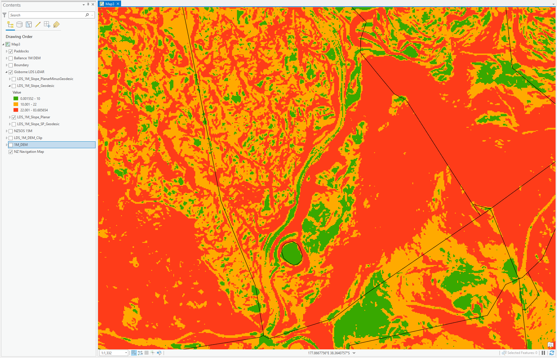
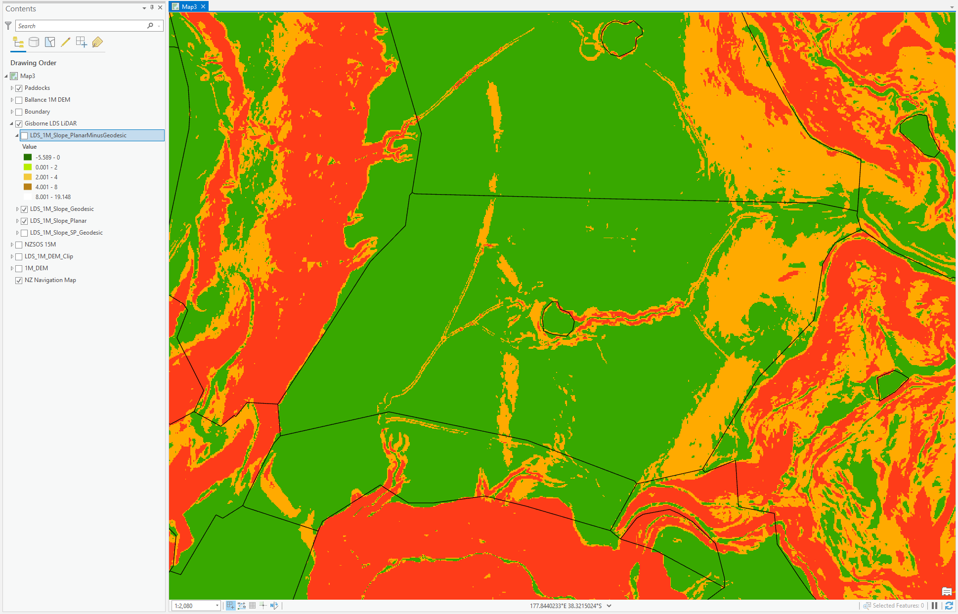
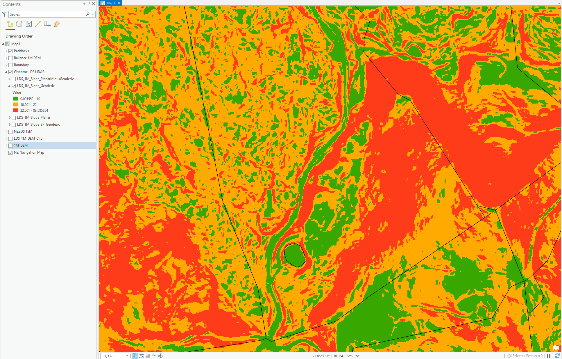
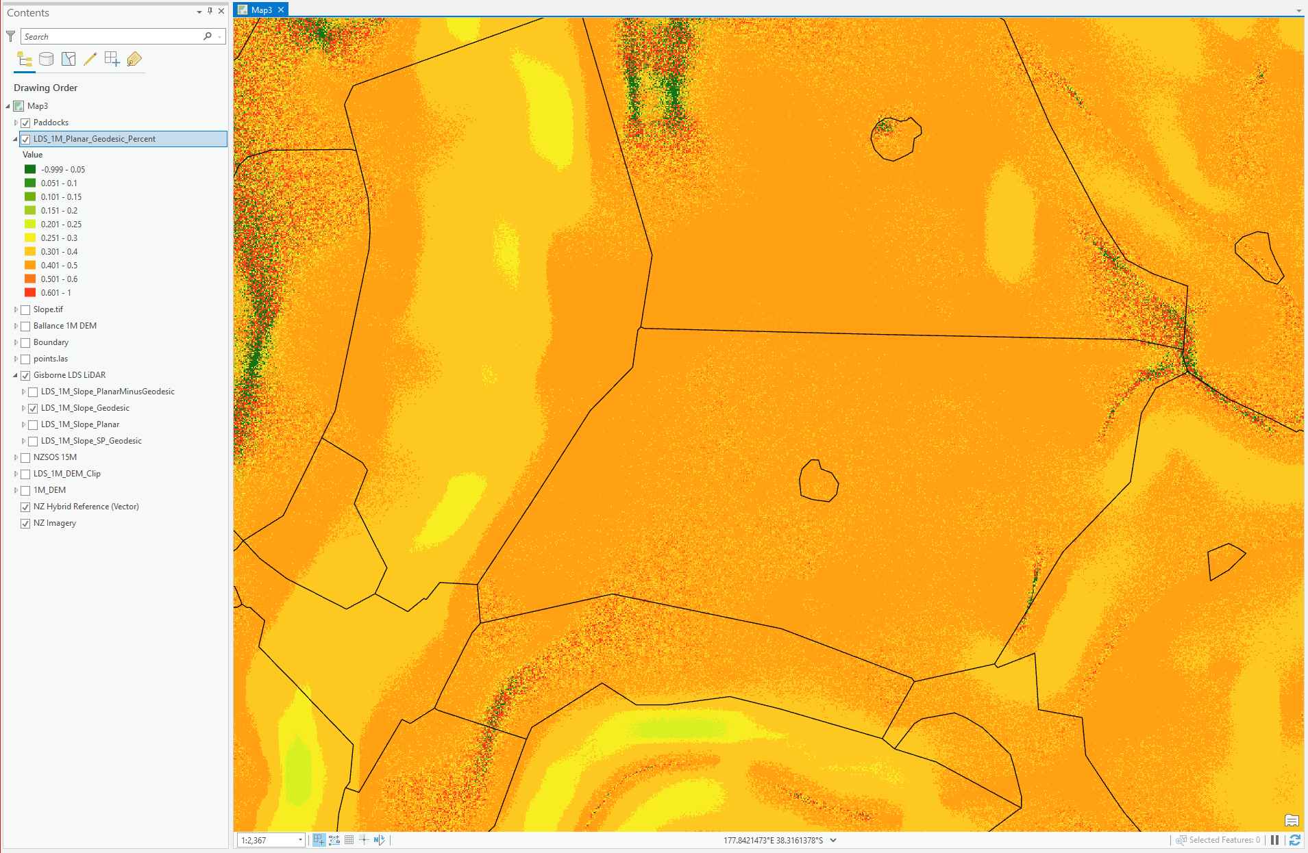
Here are some examples, the slope maps are Green (0-10), Orange (10-22) and Red (22+)
Planar: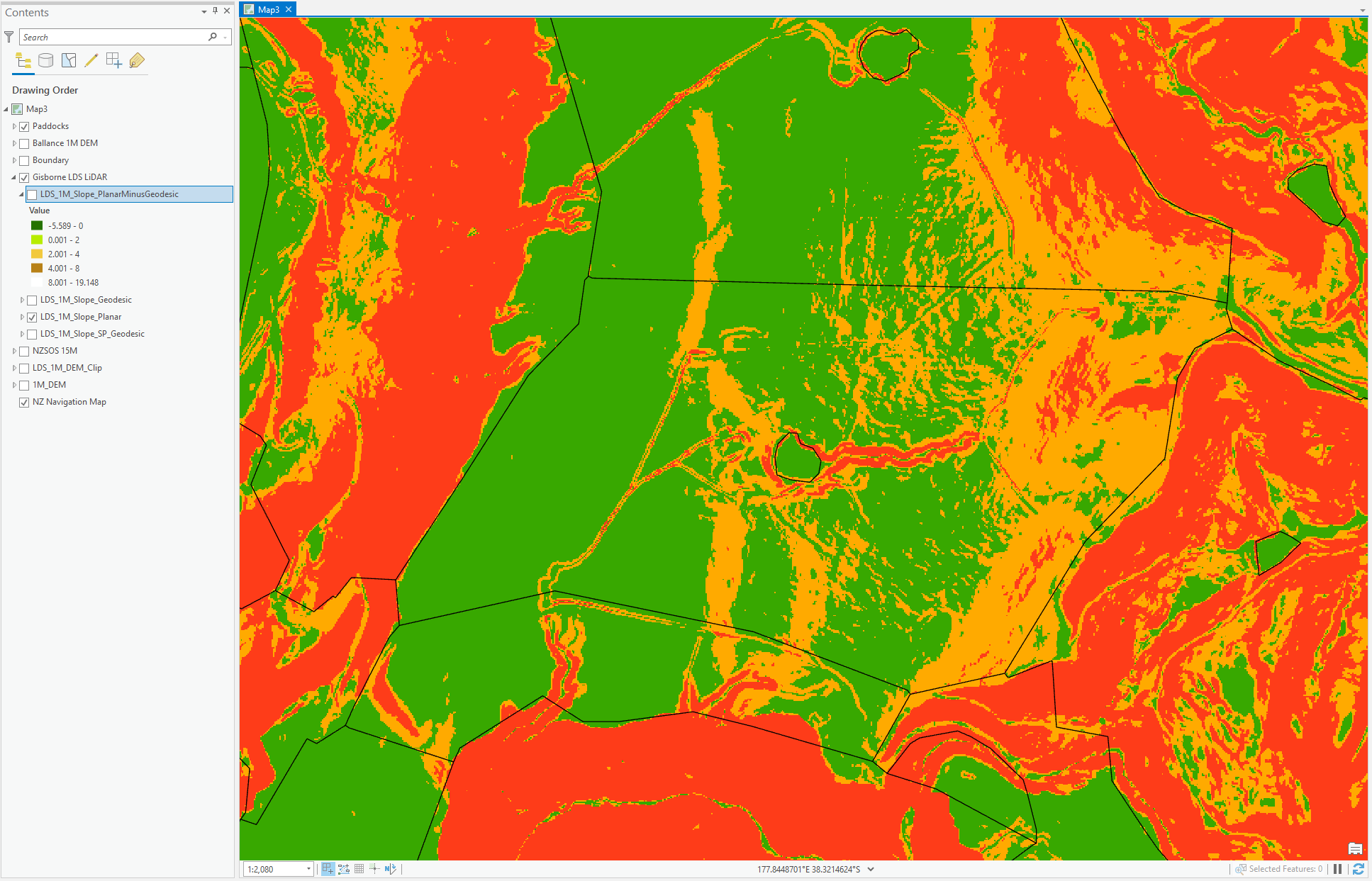
 Geodesic:
 Here are the differences between the two, Green (<2 degrees difference) Brown (<8 degrees difference) White (>8 degrees)
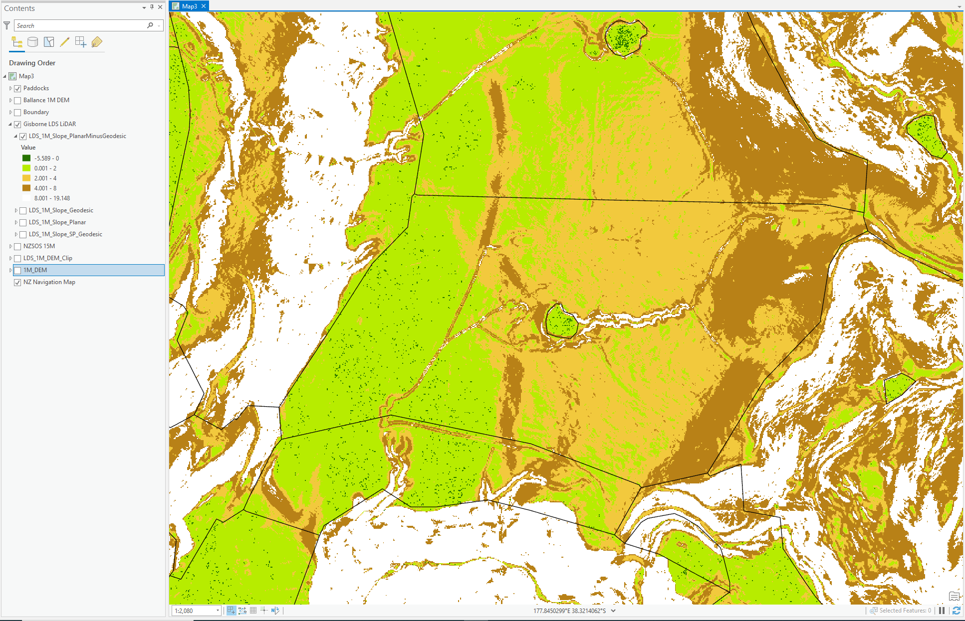
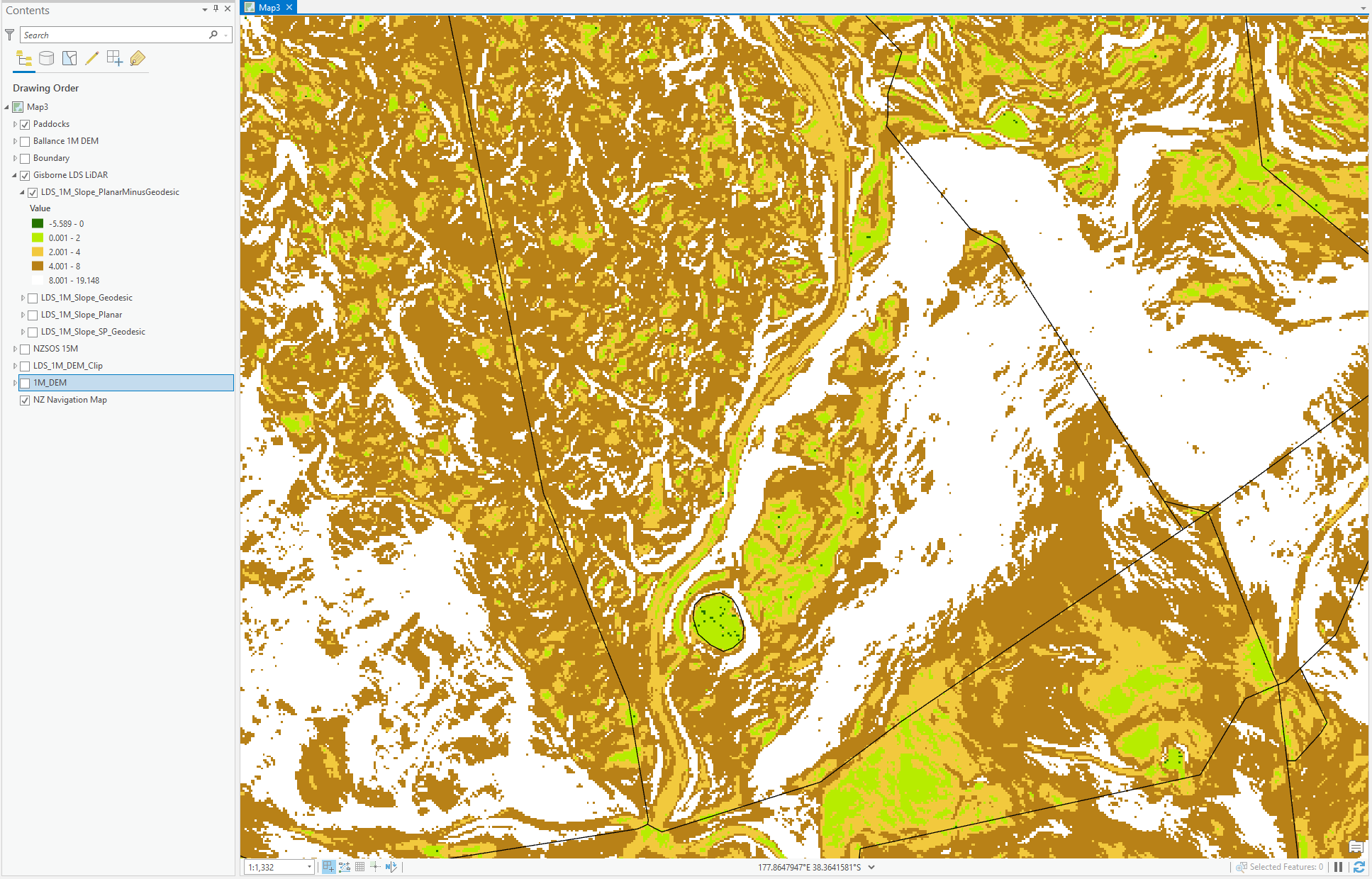


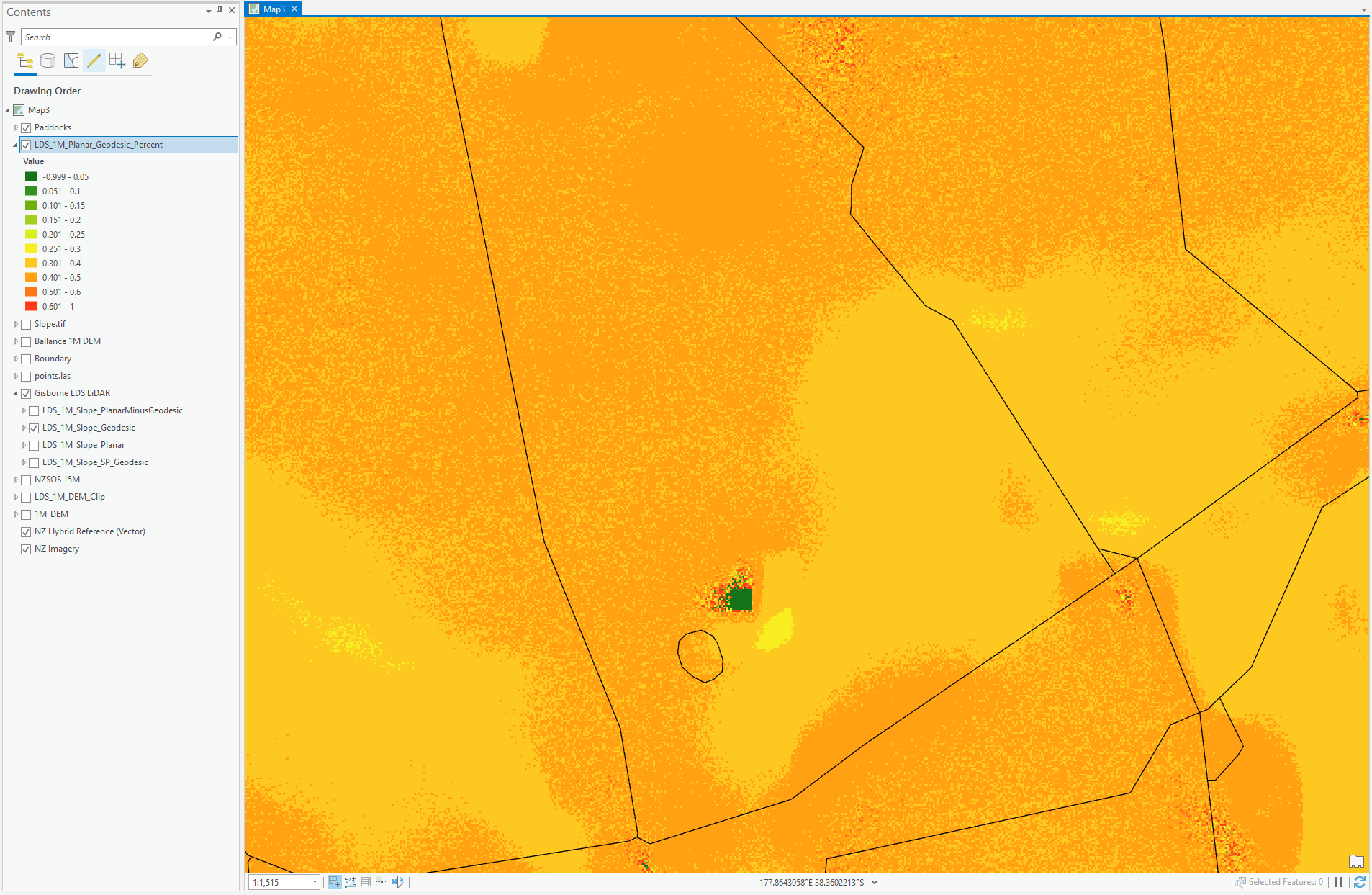 As you can see, the difference between them all is ~40% across it all.