Question

Hi All, I am new to FME, I need to convert MapInfo TAB to DWG. I have a polygon file that has attributes and I want to write those polygons and attributes to the DWG file.

  • 21 March 2022
  • 8 replies
  • 12 views

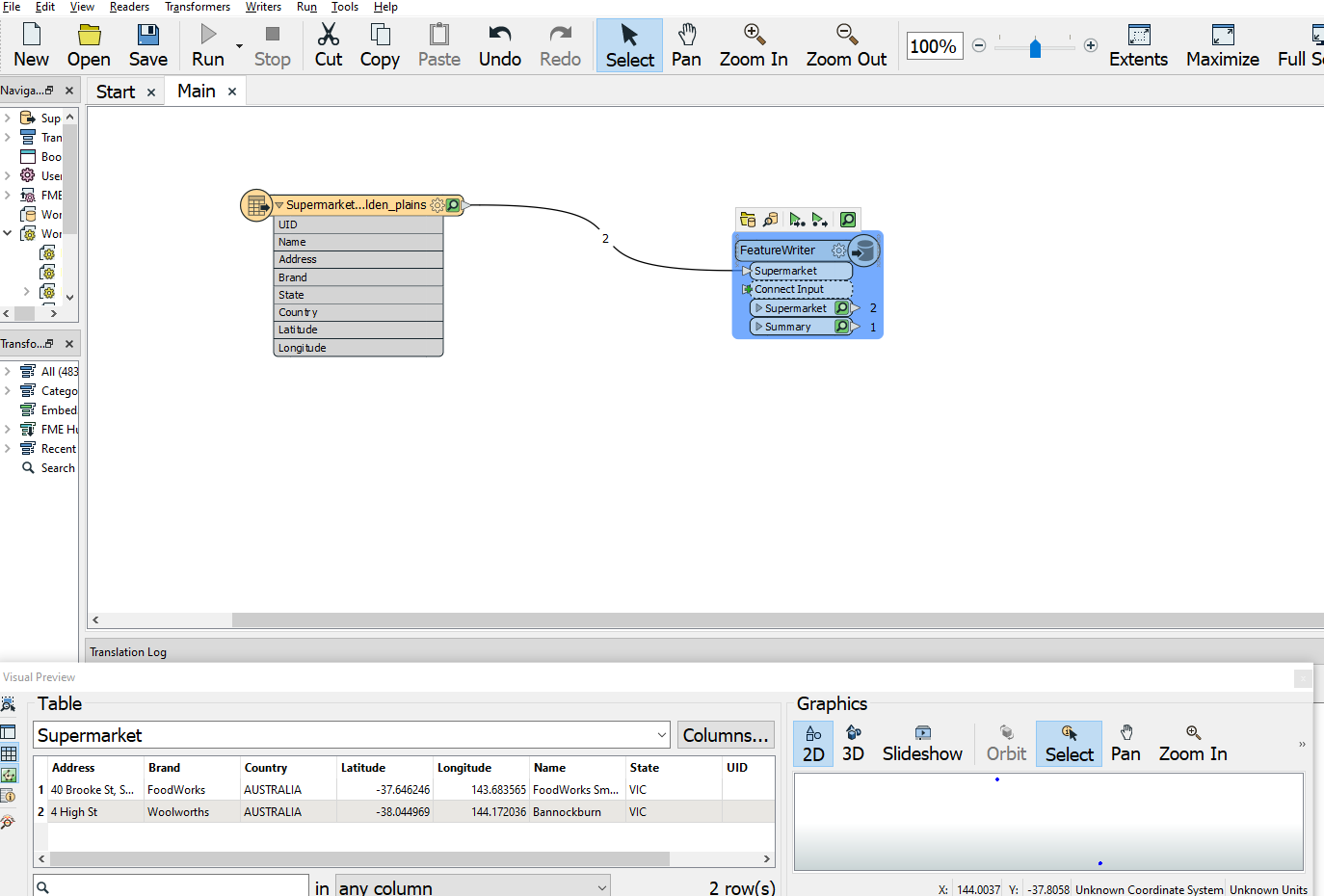
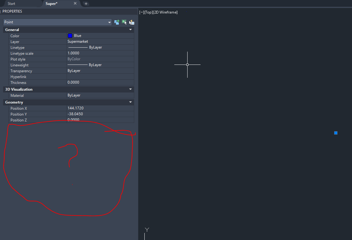
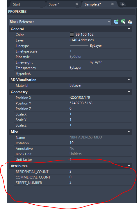
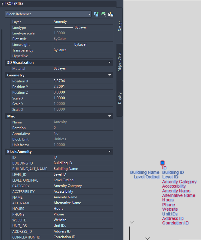
The attributes should be visible in the AutoCAD properties dialog.

I have been able to write "extended attributes" that you can list with the XDLIST command in Autocad but I want to write attributes that are visible in the properties dialog in Autocad.


Capture 

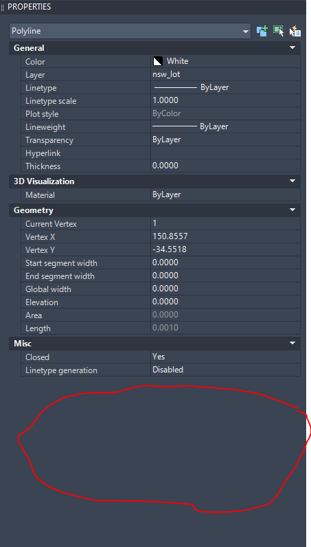
 Can anyone provide some advice on this or a sample. I think it must be simple but I am missing something???!


8 replies

Userlevel 6
Badge +32

I think you want to write Object Data. You can to use the Autodesk AutoCAD Map 3D Object Data writer to write these attributes.

I don't believe that this is possible with MPolygon features in AutoCAD. You can try with predefined attribute blocks (from template AutoCAD file) which you can import using DWGStyler.


However, I am not sure if it is possible to apply this on polygons, I have only used it for point features.


If you implement that approach, just make sure that you match attribute names in AutoCAD Writer with these in predefined in Attribute Block.


DWGStylerAttributeBlock

Thanks so much for the advice.


Are you able to provide a sample?


I am not a Autocad user and not sure how to create the template file to match.


Thanks :)

Userlevel 6
Badge +32

Thanks so much for the advice.


Are you able to provide a sample?


I am not a Autocad user and not sure how to create the template file to match.


Thanks :)

All you need to do is to select the correct writer and assign the attributes.

2022-03-22_06h13_23
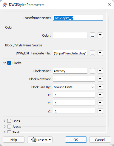
I don't understand the question about the template in this context.

Thanks so much for the advice.


Are you able to provide a sample?


I am not a Autocad user and not sure how to create the template file to match.


Thanks :)

Thanks for your help.


I tried that and was able to write the attributes to the DWG and can see them in FME however I can't see them inside the AutoCad properties, when I open the file in AutoCad.


Capture 

In Autocad the attributes aren't there?

Capture1 

I am trying to write those attributes, so that when I select the point in AutoCAD the attributes can be seen in the properties.


Something like this AutoCad file :-


Capture2 

I think this must be something people do quite often when converting GIS attributed files to CAD and want the attributes in the properties rather than as extended attributes. However I haven't been able to find a simple example.


Any ideas greatly appreciated!

Userlevel 6
Badge +32

Thanks so much for the advice.


Are you able to provide a sample?


I am not a Autocad user and not sure how to create the template file to match.


Thanks :)

I'm sorry, but as I have no Cad software at the moment I cannot help you further. I know it works this way because I created an server export gis to cad workflow to do exactly this.

Thanks so much for the advice.


Are you able to provide a sample?


I am not a Autocad user and not sure how to create the template file to match.


Thanks :)

No problem. Thanks for your help.

AutoCAD is not intended to handle attributes alongside geometry features (e.g., line or polygon) like any GIS software does. If you have access to AutoCAD Map (or even Civil 3D), then it is a different story. It is an extended version of AutoCAD that has ability to handle attributes beside each feature (i.e., attribute table). It was built as an Autodesk response to GIS technologies, but never caught up like ArcGIS or QGIS in GIS world.


If you don't have access to AutoCAD Map, you can try to make some workarounds using attribute blocks from predefined template, but I am not sure if it is possible to use that workflow with polygonal features, I used it only for points. Points are easy to import from template because they don't change the shape (1 possible variation), while each polygon have different shape.


There is no point uploading template file since all cases are unique. Modifying existing block is more complicated that creating a new one, in my opinion. Here are some tutorials how to make an attribute block in AutoCAD.

https://www.youtube.com/watch?v=jefJns5kxBw

https://www.youtube.com/watch?v=5NPxwJs19TQ

Reply