Solved

Why is the point on area overlayer not finding a spatial relationship?

  • 27 September 2021
  • 3 replies
  • 15 views

Hi everyone,


I'm struggling with the PointOnAreaOverlayer transformer. For some reason the transformer is not finding a spatial relationship when there clearly is one.


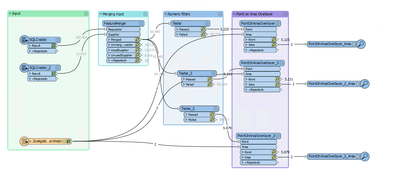
My workspace starts out with two SQL-creators (one with geometry and one without geometry) that I merge based on a matching attribute. This works as expected. Next I filter the merged dataset based on a numeric value.

After this I use a Shapefile reader and the aforementioned PointOnAreaOverlayer to count the number of points inside the shapefile polygons.


No matter what I try, the results show there are no points intersecting the polygons. I've so far checked if the FeatureMerger is merging the geometry, which it is. Checked if all the inputs are in the right projecten, which they are.


I am using user parameters to set the filter range and to set the overlap count attribute of the PointOnAreaOverlayer. Next are a few screenshots to further explain the situation. I hope you can help me with this.

 Visual Preview
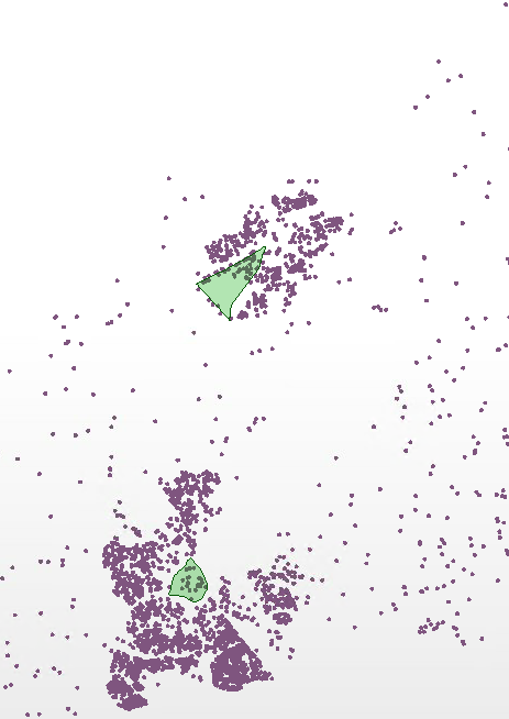
As you can see, there's a clear overlap between the points and polygons.


 Workbench overview 

icon

Best answer by speknl 27 September 2021, 12:30

View original

3 replies

Userlevel 4

It could be that FME detects a small difference in the coordinate systems from the SQLCreators and the shape file. If that is the case, there is the possibility that the PointOnAreaOverlayer will try to reproject the data first, which can sometimes lead to unexpected results. Try inserting a CoordinateSystemRemover after the SQLCreators and the Shape reader and see if that improves the results.

It could be that FME detects a small difference in the coordinate systems from the SQLCreators and the shape file. If that is the case, there is the possibility that the PointOnAreaOverlayer will try to reproject the data first, which can sometimes lead to unexpected results. Try inserting a CoordinateSystemRemover after the SQLCreators and the Shape reader and see if that improves the results.

Hi David, thanks for the quick reply. Adding a CoordinateSystemRemover after the inputs did not change the results.

It could be that FME detects a small difference in the coordinate systems from the SQLCreators and the shape file. If that is the case, there is the possibility that the PointOnAreaOverlayer will try to reproject the data first, which can sometimes lead to unexpected results. Try inserting a CoordinateSystemRemover after the SQLCreators and the Shape reader and see if that improves the results.

I found where I made a mistake. I set the Group by parameter on the PointOnAreaOverlayer. Clearing this parameter made the workflow work as intended.

Reply