


i would like to download DigitalAtlasNord Map ,is there free version to download this map to use in FME ?
or which free source map will be similar to this map to download ?
another question : i have Gis application bentley microstation,how could i use the map in bentley,do we have a method for that ?
My target : i want to use the map in FME to get Cartographic output behind object in pdf file
FME 2018
Thanks for help
Best answer by caracadrian
View original
 could u provide a sample workspace ,if u do not mind
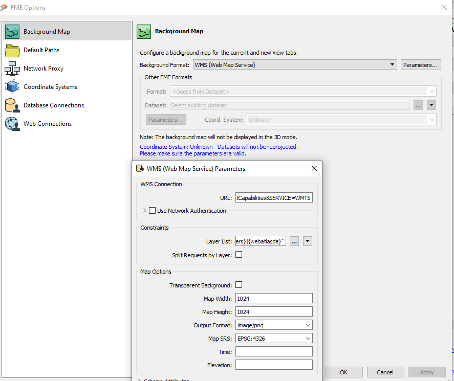
 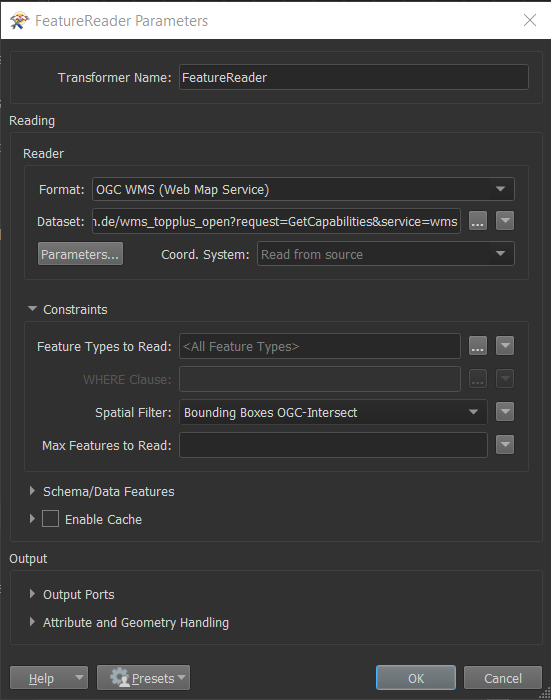 Go to Parameters and select the layer that you want, the Width and Height of the output raster, the Output Format (image/png) and the Map SRS (preferably the CRS/SRS or your data from above).
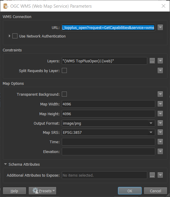 Connect something (Inspector?) to the new port that appeared on the FeatureReader ("web" in my case) and use the raster.
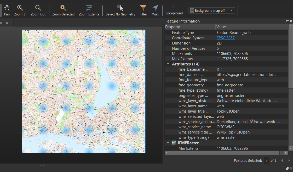 It's already georeferenced so you can sent it to a rasterizer to overlay what data you want on it (I prefer MapnikRasterizer). Send that to PDFPageFormatter to create pdf.