Hi,
I would like to know if there is any processing in FME as "Euclidean Distance" tool in ArcGIS.
Thank you.
Clara.

Hi,
I would like to know if there is any processing in FME as "Euclidean Distance" tool in ArcGIS.
Thank you.
Clara.


If you simply need the euclidean distance between two points, the easiest is maybe to create a line between those two points (2 x VertexCreator) and then something like the GeographicLengthCalculator from the FME Hub.
Hi david. yes... i am also in dire need of euclidean distance (raster) in FME... GLC is not adequate since I'm am generating a land suitability index based on continuous data...
Hi david. yes... i am also in dire need of euclidean distance (raster) in FME... GLC is not adequate since I'm am generating a land suitability index based on continuous data...
I'm not sure I understand the question. For maximum visibility, the best is probably to repost as a separate question. Make sure to include as much detail as possible, including sample data and/or screenshots, if possible.

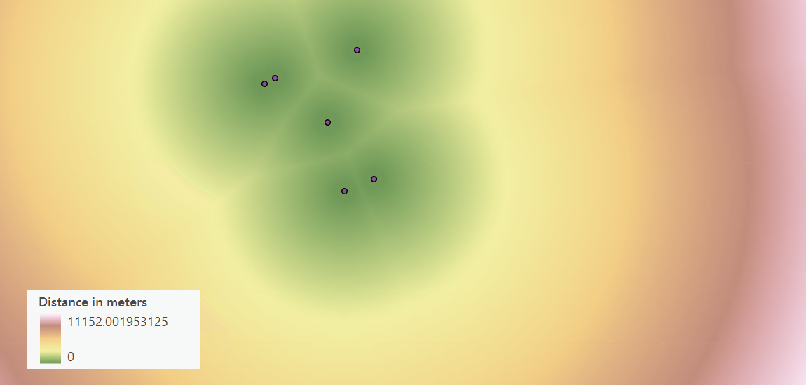
Hello,
I am also hoping to find an equivalent to Euclidean Distance raster from ArcMap in FME. The idea is to input a shapefile (ex. points representing bus stops) and generated a raster with a specific resolution, where each pixel holds a value representing the distance to the nearest point from this pixel.
 Cheers,
Enter your username or e-mail address. We'll send you an e-mail with instructions to reset your password.
