Solved

How to combine LeftRightSpatialCalculator and NeighborFinder

  • 24 January 2018
  • 4 replies
  • 3 views

Hi guys,

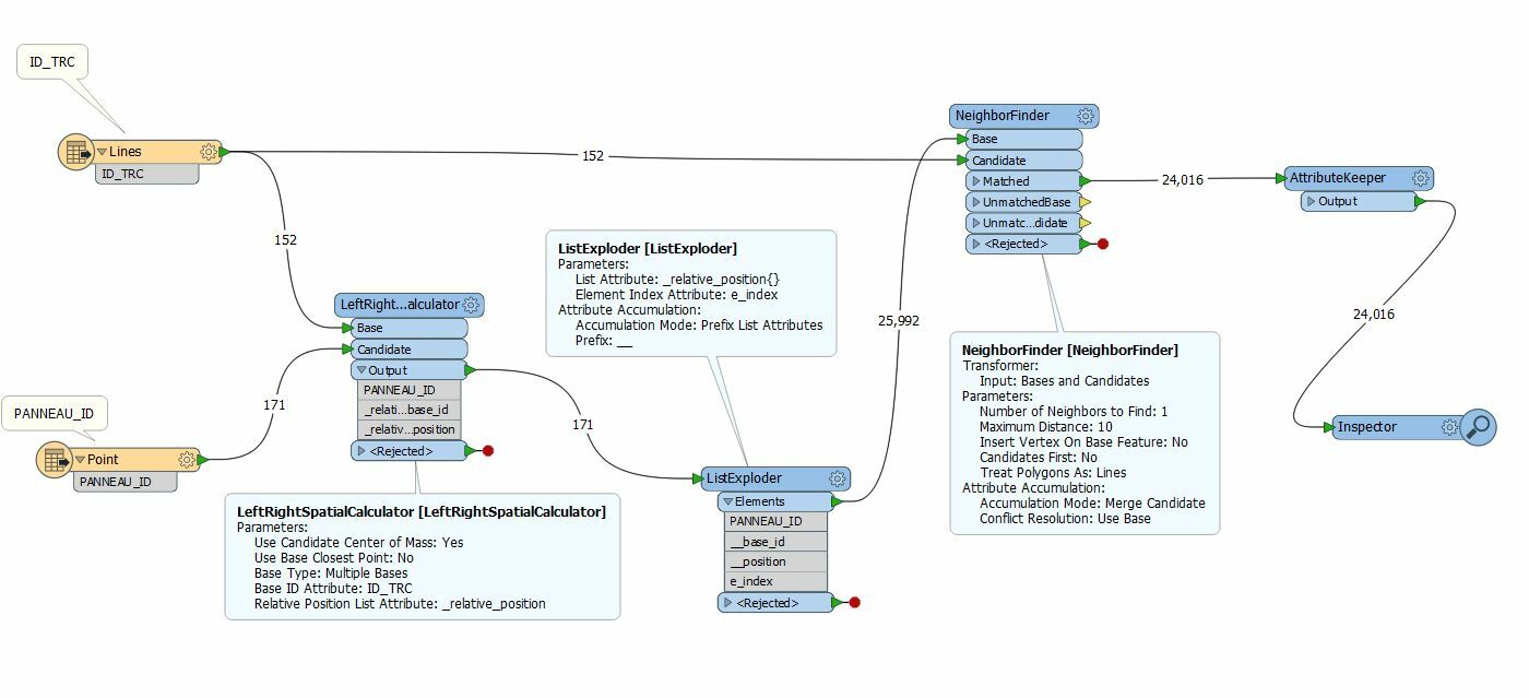
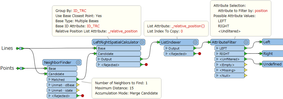
I have 02 shapefiles (point and line), I want to find the nearest line for each point [relation 1 (line) to many (point)] inside a diameter of 15m and to find the relative position of those points.

Thanks for help

icon

Best answer by takashi 25 January 2018, 09:47

View original

4 replies

Userlevel 2
Badge +17

Hi @messaoud2010net, if I understand the requirement correctly, this workflow might help you. Assuming that "ID_TRC" is an attribute which can be used to identify each line uniquely.

??????????

M. takashi You're so helpful

Badge

Hi @messaoud2010net, if I understand the requirement correctly, this workflow might help you. Assuming that "ID_TRC" is an attribute which can be used to identify each line uniquely.

@takashi

Hi Takashi


I seem to receive an 'INVALID_BASE_GEOMETRY_TYPE' rejected error when I set my workbench as specified. Would you know what is causing this error please?


Thanks

James

Userlevel 1
Badge +10

@takashi

Hi Takashi


I seem to receive an 'INVALID_BASE_GEOMETRY_TYPE' rejected error when I set my workbench as specified. Would you know what is causing this error please?


Thanks

James

Response provided here: https://knowledge.safe.com/questions/98254/leftrightspatialcalculator-produces-and-invalid-ba.html

Reply