


Heyhey and happy new year, Im fascinated with the 3D PDF possibility of FME and am constantly making some needlessly-over-complicated things in it (of course)
Up to now I have mainly just been taking either stuff straight out of Revit for buildings/structures to a 3D PDF or draping TIN's with areal photography or other rasters to make nice 3D landscape.
Now I want to include vector data in my landscapes, for example not only drape a TIN with areal photography but also drape it with contours (lines) and areas (polygons) and even perhaps somekind of a structure (based on a point).
Ive googled around and tried many things but I just have not succeeded, so could anyone suggest a workflow where I:
-Introduce vector data (point. line, polygon)
-Set the symboligy of that vector data (color, thickness, opacity...)
-Drape a TIN with that symbolized vector data (Use the 'Appearance setter'?)
-Export that to a 3D PDF (remembering that I already know how to make it with Raster and TIN, just not vectors).
Any suggestions?
And a bonus questions: how on earth does one set the drawing order of multiple data in the 3D PDF and assign the following layers in the 3D PDF with appropriate names (instead of [File name]#Number?
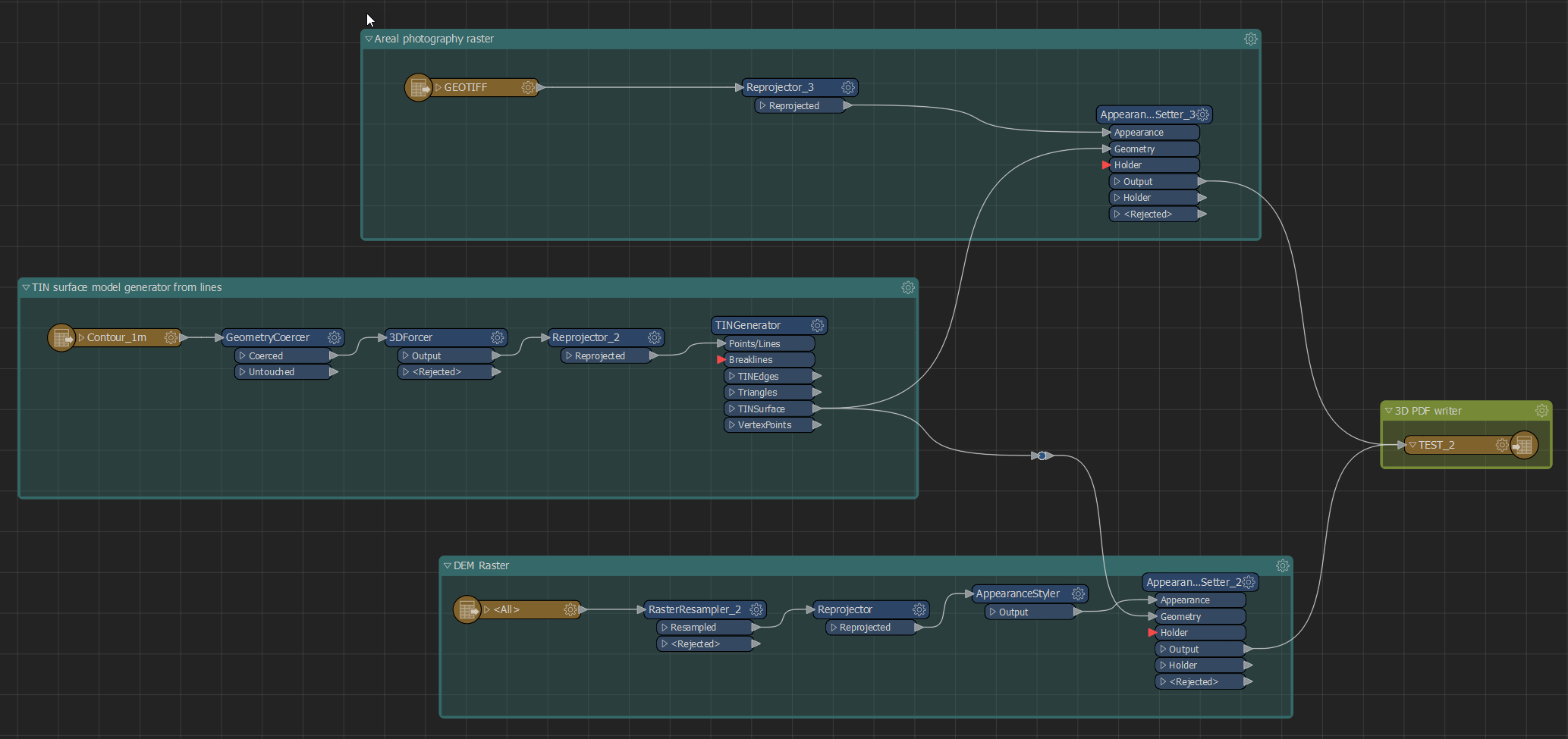
Here is how a usual workspace of mine making 3D PDF dsiplaying areal imagery and hillshade on top of a TIN would look like:
Best answer by sigtill
View original


