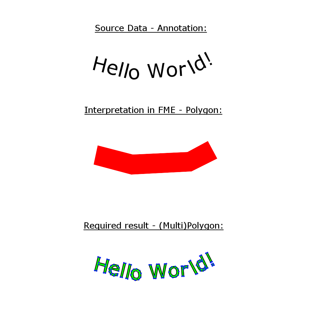
Is it possible to work with Esri Annotations in FME?
My source data set is a file geodatabase created with ArcGIS. It contains a few texts as annotations. When I read them with the FME Data Inspector not the texts are shown but the encircling polygons of the texts and just those areas are editable in the workbench. In my workbench I want to convert the text strings into polygons or polylines with the TextStroker for example but that is not possible if FME cannot interpret the annotation texts correctly. My aim is to get a represantation of the text strings in a (multi)polygon format that looks exactly like the texts in the input feature in ArcGIS.