


Hello FME Gurus,
I have a puzzling situation that I am trying to overcome while trying to validate the length of line segments from my DWG file.
In the drawing there are labels which define the running chainage distance of a straight line. The chainage distances start from a zero position and a running distance is given at intervals along the line. The interval may be a single line segment or a combination of multiple straight line segments.
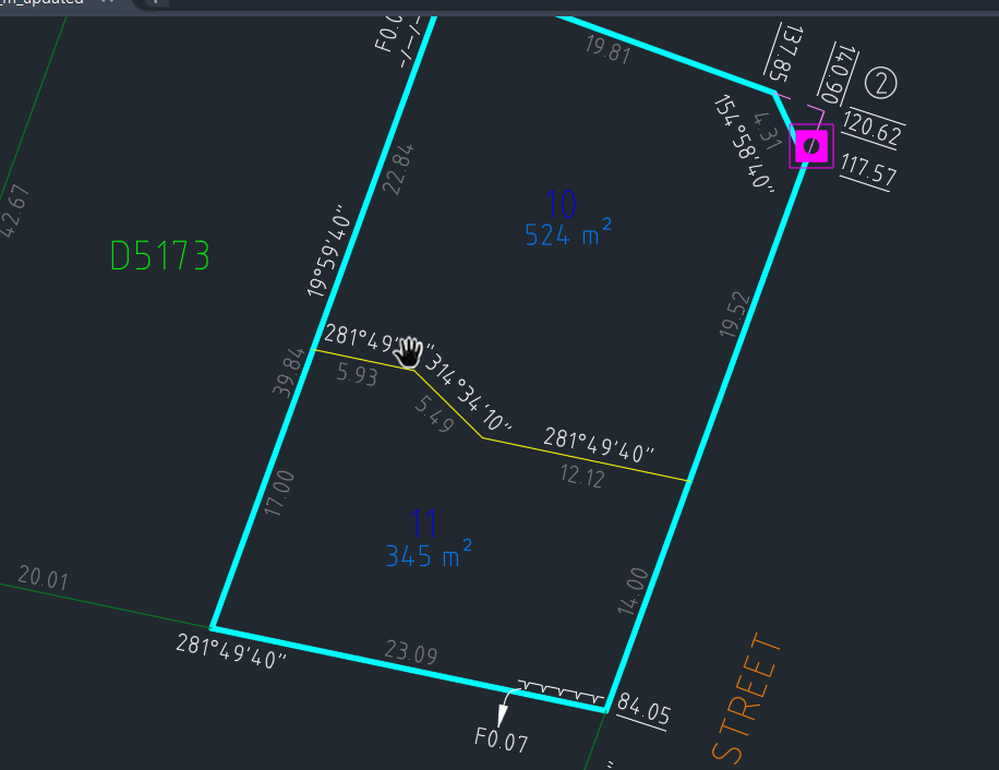
In the example above there is a label of 84.05 metres and then one of 117.57 metres hence a line segment length of 33.52 which is made up of two line segments of 14.00 and 19.52.
My thought process is to get the x and y coordinate from the label 84.05 and the x and y coordinates from the label 117.57, create a line and do a line on line overlayer or neighbor finder, get the list of closest lines with the same bearing and then get the combined length of the lines between the two points.
My problem is I just can't figure out how to iterate through the list of labels and get the current label coordinates and the next label coordinates to then create the line to do the spatial intersection.
Any assistance would be very much appreciated.
Regards
Dean