


Hi,
I'm trying to find the correct workflow to georeference a raster when the lat and long is stored in it's bands.
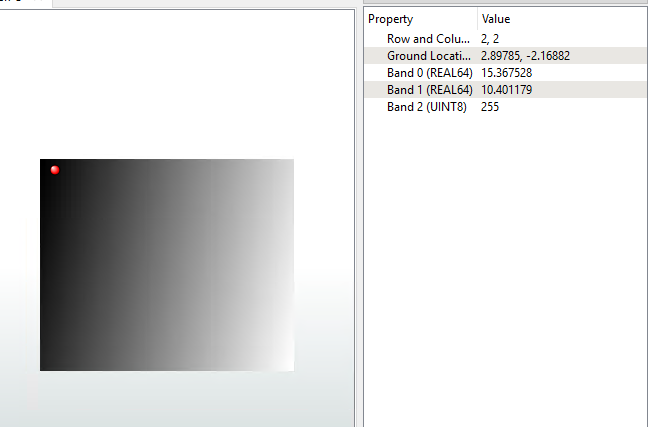
I have a raster that has 3 bands:
- longitude (band 0)
- latitude (band 1)
- OLCI Terrestrial Chlorophyll Index (band 2)
I think if I can dynamically pull the lat and long for the 4 corners of the raster, then I can use the corner x and y in the "rastergeoreferencer" transformer to correctly georeference it. I need this to be dynamic as the extent of the rasters may be different.


