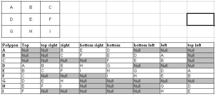
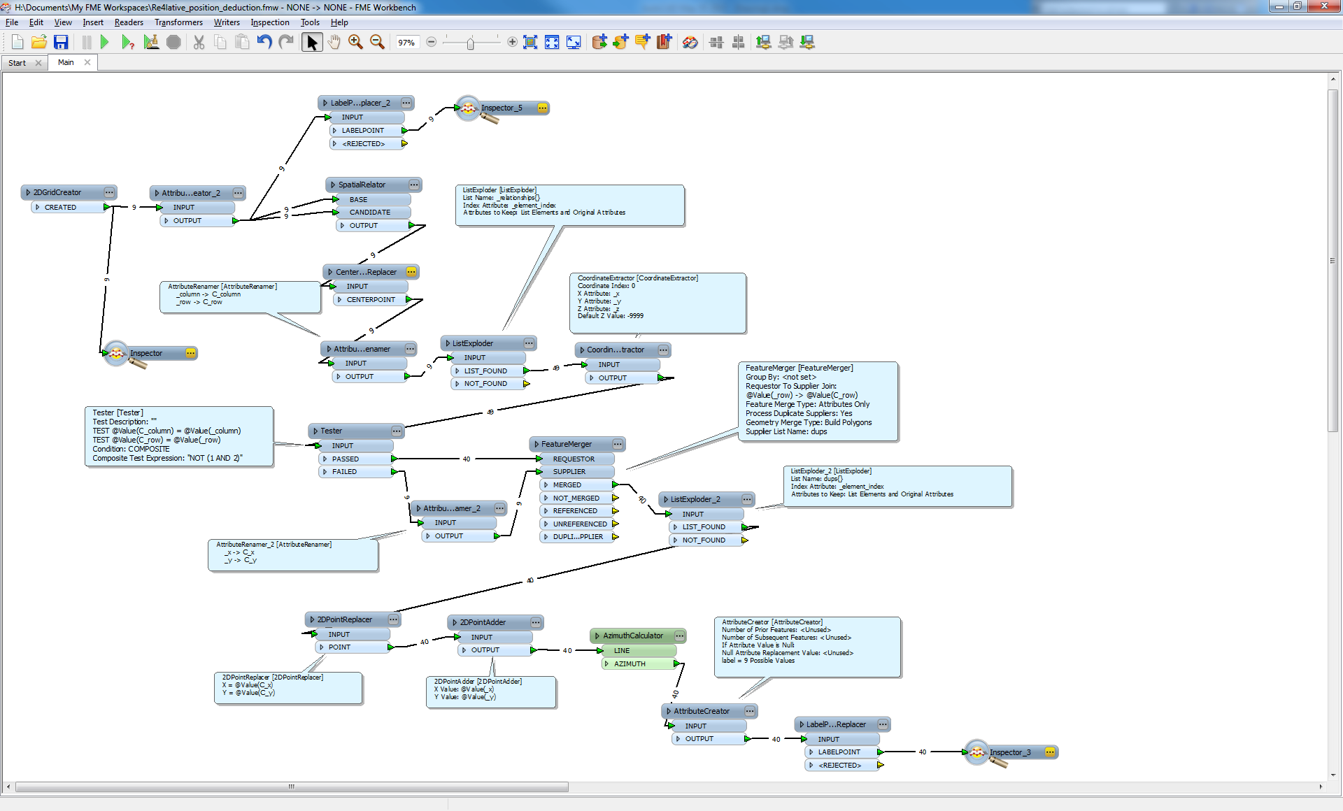
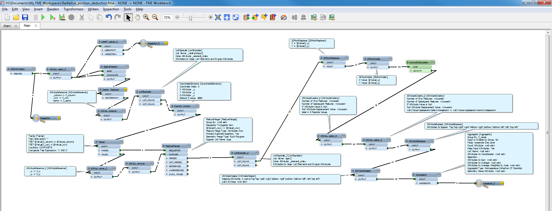
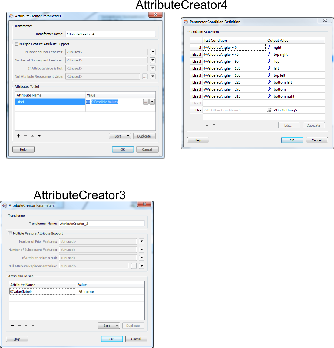
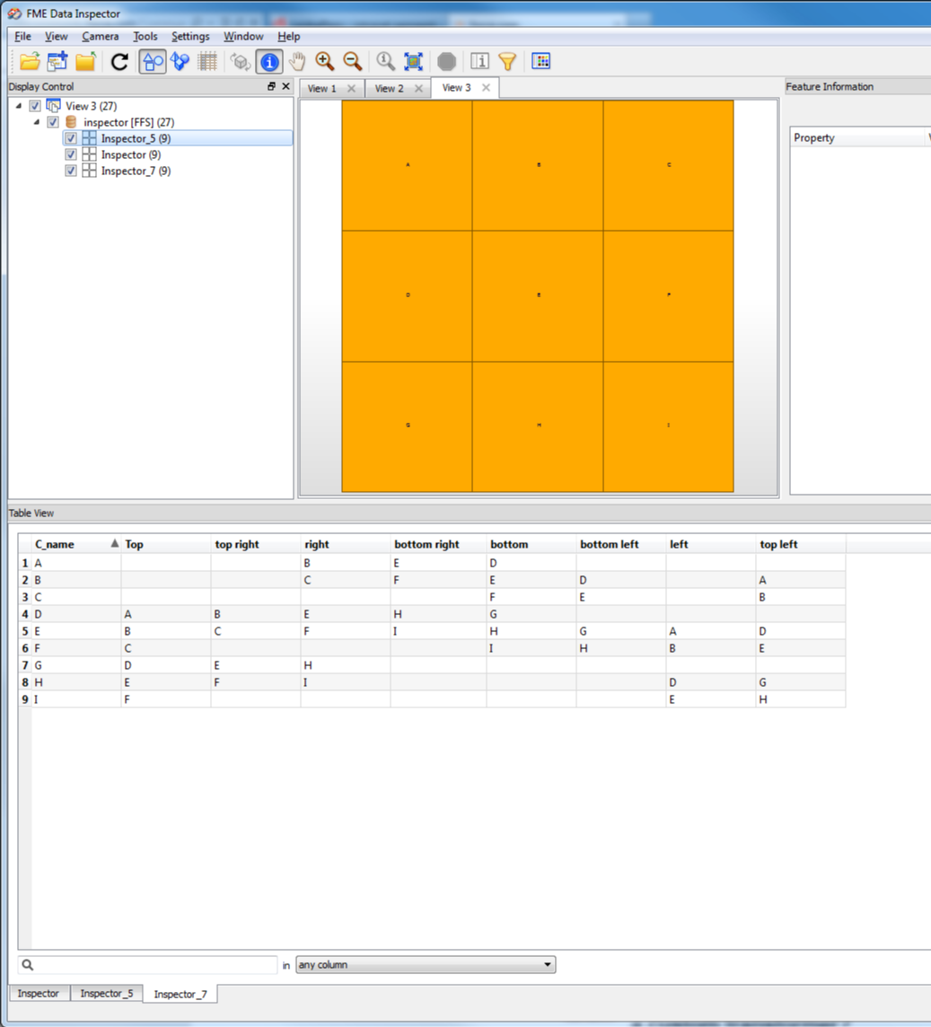
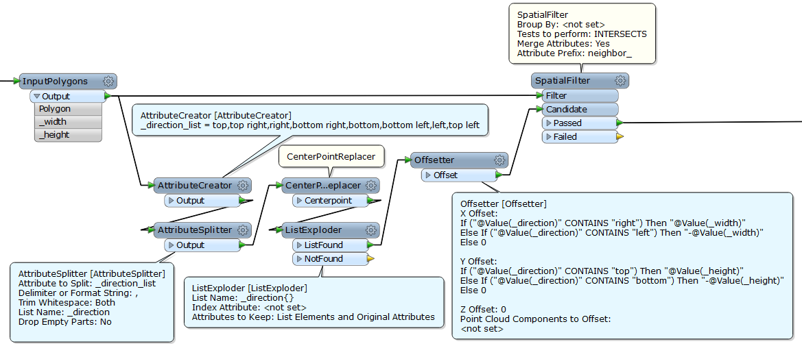
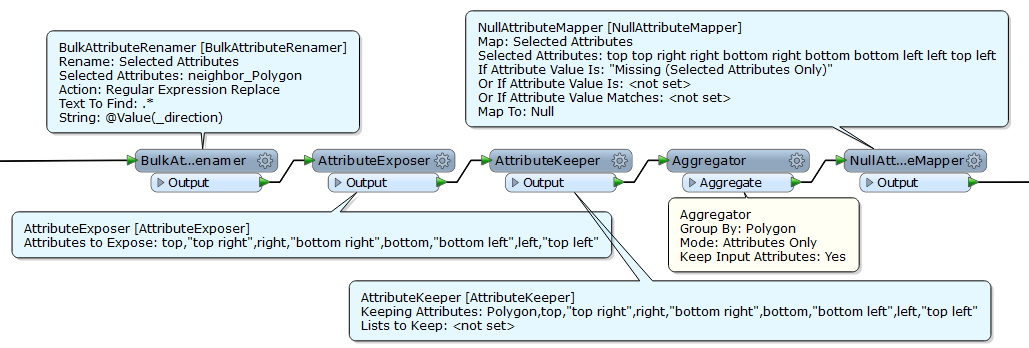
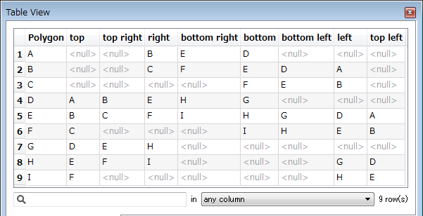
hopefully someone can answer my query. I have a sample block of polygons and i want to know the location of each of the features that touch each polygon (top, bottom, left, right etc). all my data is in a grid with an example below. So i want to know the positions of each polygon against the other features. I can use the spatial relator and list concatenator to identify all the polygons which touch each polygons, but is there a way to identify the tiles relation further as in my example table below? i've looked at the left right calculator but to no avail.
Anyone have any ideas?