Solved

Time lapse map for construction over time across BC

  • 31 October 2019
  • 2 replies
  • 2 views

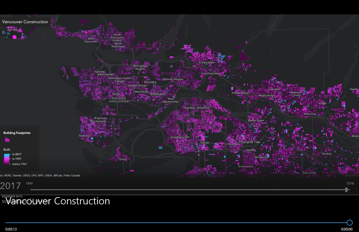
Hello.. I was wondering if it is even possible to create a time lapse map scene for construction happening across BC over time. Please have a look at the snapshot of the video. This is something i am looking for. Any ideas folks?

Thanks in advance

icon

Best answer by mark2atsafe 31 October 2019, 21:04

View original

2 replies

Userlevel 5
Badge +25

Assuming you have building footprints with year of construction: set up a 2-tier approach, one workspace that goes through a list of years that calls a second workspace that generates an image of all buildings with a construction date of that year or older. Then combine the images into a movie.

Userlevel 4
Badge +25

A nice way of doing this is to use KML. The KMLTimeSetter transformer will let you enter a timestamp or start/end time period for each feature. Then you write to a KML dataset. Open the file in Google Earth and you get a play/run button that animates the data series over time. I've done something similar to show the track of hurricanes over time.

Of course, the limitation is that you're then restricted to Google Earth as a display tool. But I expect you could record the screen as you play it back to create an actual movie file.

The other method - as Hans notes - is to write the data as a series of images and use a tool to turn that series of images into a video.

Reply