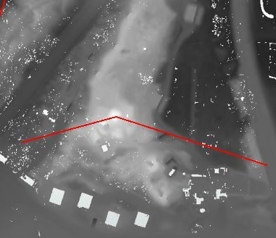
I have got line objects, and a rasterdataset with elevation data.
I try to get both minimum and maximum elevation values as an attribute to the lines, but just can't find out how.
Does anyone know how to do this?

I have got line objects, and a rasterdataset with elevation data.
I try to get both minimum and maximum elevation values as an attribute to the lines, but just can't find out how.
Does anyone know how to do this?


 +22
+22
Buffer the line by a small amount, clip the raster, RasterBandMinMaxExtractor, FeatureJoiner to attach back to the original line.
Use a counter if your lines don't already have a unique ID. It may be more efficient to convert the clipped raster to a point cloud and use the PointCloudStatisticsCalculator to get the Min/Max.

 +17
+17
Hi @arjen,
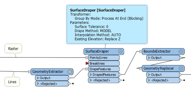
Another method would be to use the SurfaceDraper transformer. Connect the elevation data to the Points/Lines input and the lines to the DrapeFeatures input. In the transformer settings, set Drape Method to MODEL. Connect the DrapedFeatures output to a BoundsExtractor to get the min/max elevations.
The lines will now have more vertices and be 3D. If this is not what you want, you can use a FeatureMerger to merge the min/max elevation info on a copy of the original features, or you can store the original geometry before draping with a GeometryExtractor and restore after getting the bounds with a GeometryReplacer.
Hi @arjen,
Another method would be to use the SurfaceDraper transformer. Connect the elevation data to the Points/Lines input and the lines to the DrapeFeatures input. In the transformer settings, set Drape Method to MODEL. Connect the DrapedFeatures output to a BoundsExtractor to get the min/max elevations.
The lines will now have more vertices and be 3D. If this is not what you want, you can use a FeatureMerger to merge the min/max elevation info on a copy of the original features, or you can store the original geometry before draping with a GeometryExtractor and restore after getting the bounds with a GeometryReplacer.
Thank you, this is exactly what I was looking for.
Enter your username or e-mail address. We'll send you an e-mail with instructions to reset your password.

