
Could anyone please explain in simple language what "surface tolerance" is regarding the transformer "Contour generator". What units are used? If I specify a surface tolerance of 1, which coordinates are filtered out?

Could anyone please explain in simple language what "surface tolerance" is regarding the transformer "Contour generator". What units are used? If I specify a surface tolerance of 1, which coordinates are filtered out?


 +25
+25
The way I understand it that tolerance is the minimum z-difference (in whatever units your data is in) needed for a point to be added to the surface model.
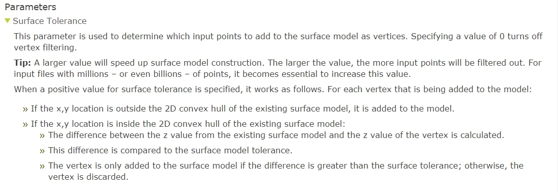
The below example may give you clear answer
Enter your username or e-mail address. We'll send you an e-mail with instructions to reset your password.
