Hello,
I would like to create the Dist CLoud/Mesh tool of CloudCompare.
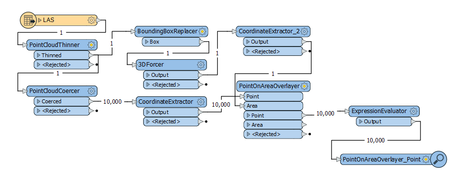
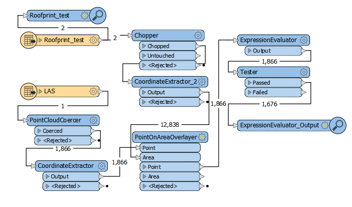
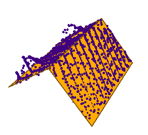
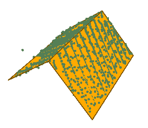
I have 2 input files. One is individual points (PointCloudCoercer : Individual Points) from the class Building of a Lidar point Cloud and second is polygons representing roofs in SHAPEFILE. I wanted to measure the (vertical) distance from each point to the nearest polygon.
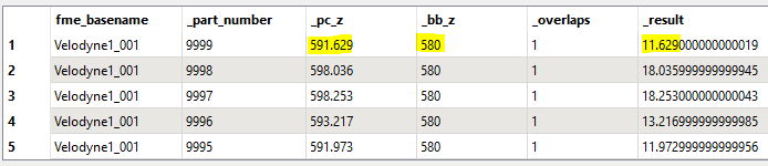
I firstly used the SurfaceDraper to drape the points into the roof, then measure the distance between the draped point and the original points, but it didn't work as you can see below.
Do you have a solution to my issue ?
Thank you in advance,
Victor
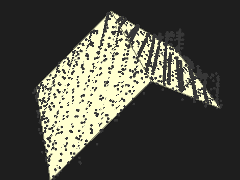
Point cloud :
You can find the Shapefile polygon via this link: https://wetransfer.com/downloads/291f3edefb457b27a0f286ca68e3420120200624124047/919a8805a20a2c4b08eee3a830f2776e20200624124104/84c603
Best answer by jlbaker2779
View original