Solved

Pointcloud and Joint spatially

  • 17 June 2019
  • 4 replies
  • 10 views

Badge +7

Hello,

I would like to merge pointcloud data spatially.

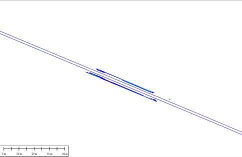
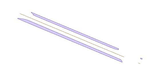
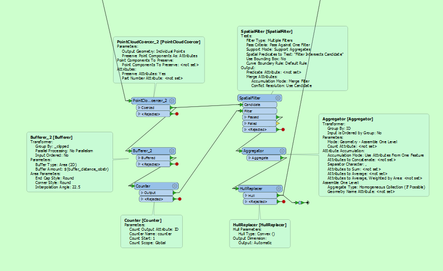
To do that, I create polygons representing the hull of point cloud data using the following steps:

  • coerce point cloud data to individiual points,
  • Bufferer every individiual point
  • Dissolve the buffers that overlaps/intersects
  • Create a polygon using hull replacer

How can I perform such operation without using a pointcloudCoercer because it is too much time consuming.


Any idea on how to improve this part of my workbench?

Thanks

icon

Best answer by takashi 18 June 2019, 12:00

View original

4 replies

Badge +7

From this,


I would like to be able to obtain


@takashi and others, any ideas?

Userlevel 2
Badge +17

From this,


I would like to be able to obtain


@takashi and others, any ideas?

Is the source dataset is a single point cloud and do you need to separate the points within the point cloud into some groups according spatial proximity?

Badge +7

Is the source dataset is a single point cloud and do you need to separate the points within the point cloud into some groups according spatial proximity?

Correct @takashi. The data source is a single point cloud.

Userlevel 2
Badge +17

I don't think there is so efficient way, but a better way at least than the PointCloudCoercer is:

  1. NumericRasterizer (Size Specification: CellSize): Transform the point cloud to a numeric raster, filling background with Nodata.
  2. RasterExtentsCoercer (Extents Type: Data Extents): Transform the data existing areas of the raster to a multiarea.
  3. Deaggregator: Decompose the multiarea into individual polygons.
  4. Clipper: Clip the original point cloud by the polygons (i.e. separate the point cloud into groups).
  5. HullReplacer: Transform the clipped point clouds to hull polygons.
  6. Bufferer: Make buffers from the polygons if necessary.


Reply