I am a beginner in FME and have very limited knowledge of it. I would like to join a polygon shape file, with an Excel spreadsheet that shares a common ID , then convert the joined file to DGN.
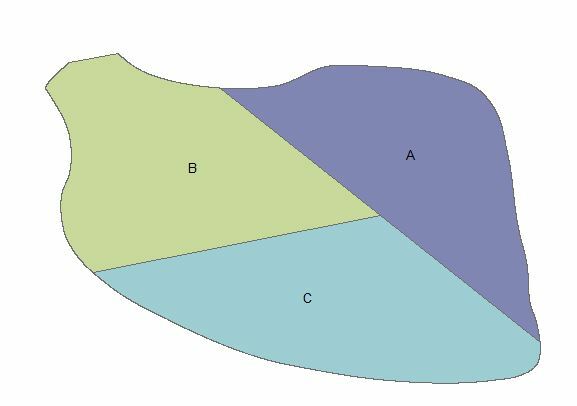
My shape file looks like this :
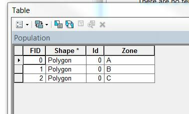
The attribute table:
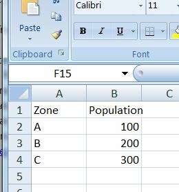
Spreadsheet:
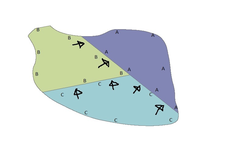
For the result, I would like to have the DGN showing arrow heads along the polygons, pointing to the area with the lower population:
This is getting way harder that I thought it would be. Would someone help me please? Any suggestion will be greatly appreciated! Thank you so much!!!!