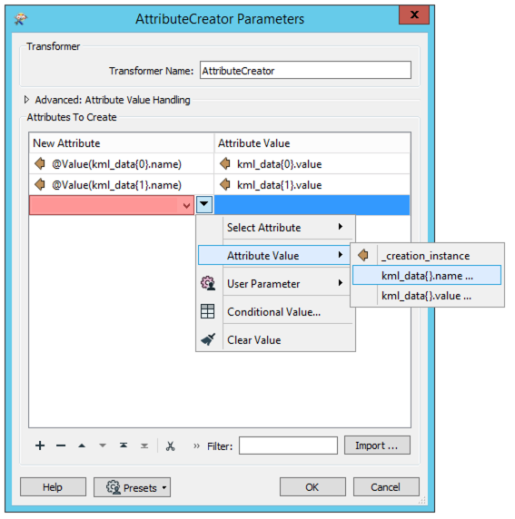
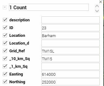
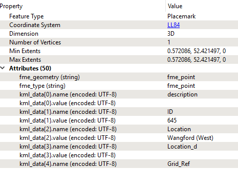
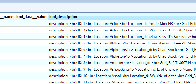
 I have an editable KML with all its user attributes showing in a data table in Google Maps - showing as above when I click on the map objects. I want to be able to export that data back out of Google Maps to TAB or Excel (or anything!), with all these user attribute fields. However, when I export this from Google Maps and look at the Feature Types of the KML Reader in FME Inspector, there are no User Attributes, only Format Attributes. When I use the Inspector, the attributes look as below - there are no kml_schema_ attributes, only kml_data attributes with name (attribute column heading) and value, each one suffixed 1, 2, 3 etc. So when I use a simple workflow with no transformers to export this to TAB, all user attributes are concatenated into the kml_description field as shown below. I have a feeling this isn't normal...……. My original export to KML for Google Maps was from a Shapefile using QGIS export tool (I removed text from "DescriptionField"), and the data displays as I want it to in Google Maps.
I would be very grateful for any help. Thank you, Jane
Best answer by daveatsafe
View original