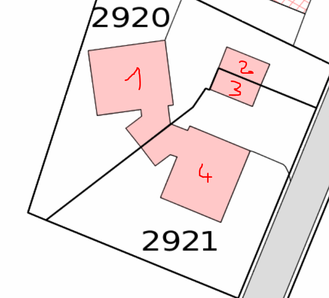
I have one reader with buildings (areas), and one with parcels (also areas, having 2 attributes: parcel_no, parcel_id). I would like to output an Excel file of every building, with the parcel or parcels where it is located, separated with a "/". For example:
Building_noParcel_no
Parcel_id
1
1051/1052
P0356684/P0356685
2
1053/1054
P0264568/P0258934
3
1102
P0256425
4
1173
P0546742
Parcel_no and parcel_id have to be in the same order.
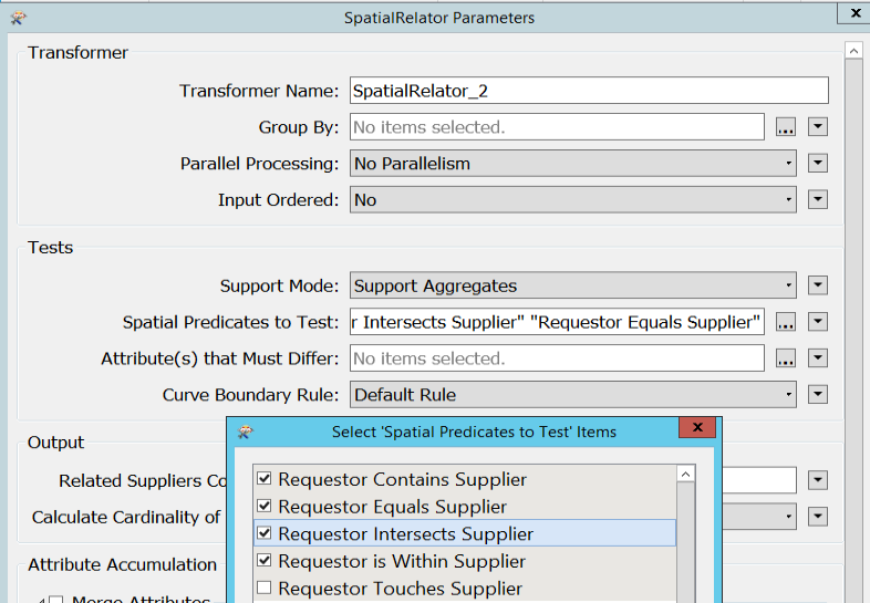
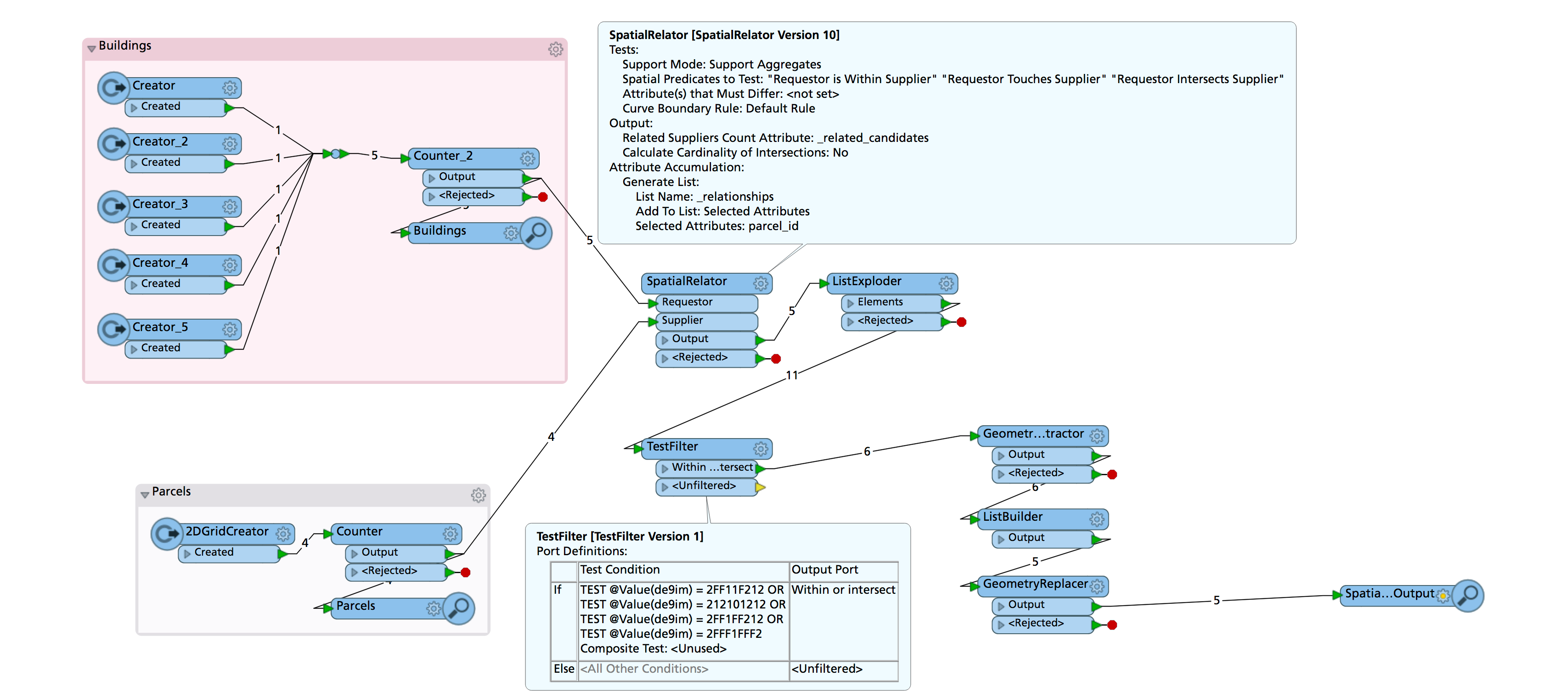
What should I use (SpatialRelator or AreaOnAreaOverlayer)? What options should I select?
And then, how can I aggregate the fields in one field (ListRangeExtractor, Aggregator, other...)?
Additionnal question: can I list only the parcels where the building occupies more than 5 square meters (to avoid parcels that are juste a little bit on the edge)?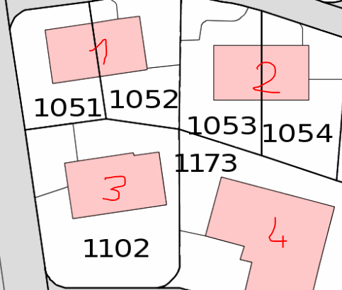
Best answer by redgeographics
View original