Question

UAV imagery to blend into Aerial Imagery

  • 6 October 2017
  • 2 replies
  • 3 views

Badge

Hi all,

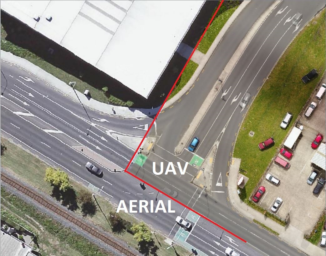
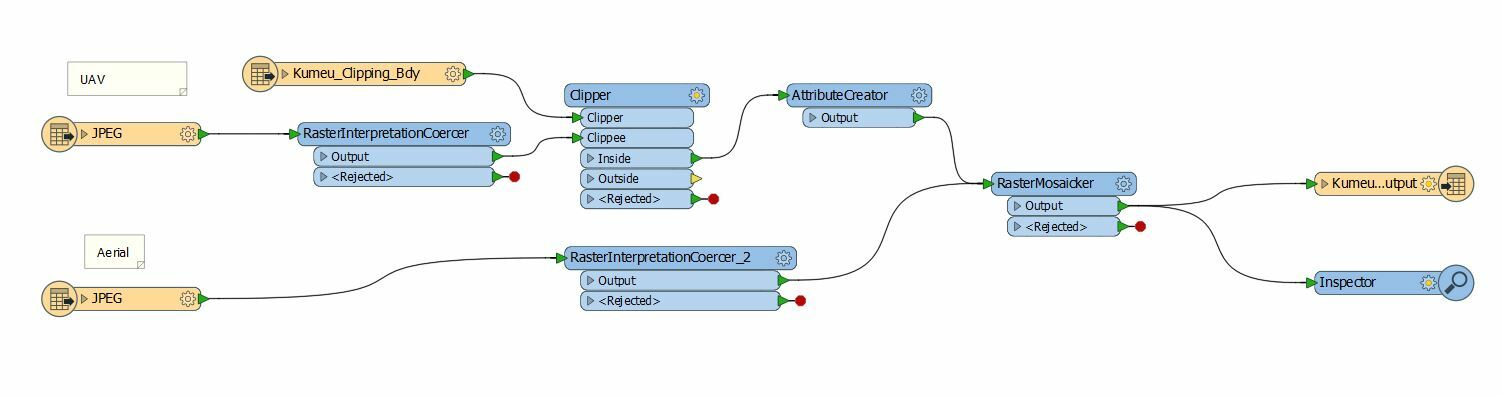
I am having issues with blending captured UAV orthomosaic (.jpg) into aerial imagery (.jpg as well). I used a few approaches including creating boundary polygon to use as a clipper as well as setting alpha band to exclude black edges to mosaic with aerial imagery. As a result I get merged images with white edges instead.

I looked at couple of solutions that floating around knowledge center but did not get it working. If anyone can suggest a solution that would be great.

Cheers,

Maksym


2 replies

Userlevel 2
Badge +17

Hi @mkhovalko,

The workspace looks good, but we may need to check some of the transformer parameters. Please check the following:

- Both RasterInterpretationCoercers are coercing to RGBA32

- The RasterMosaicker Has Overlapping Values set to Composite using Alpha Band

Badge

Hi @DaveAtSafe, thanks for your reply.

You are correct, the only setting that I had to change was RasterMosaicker to Overlapping Values set to Composite using Alpha Band.


I had to geo reference Aerial imagery to fit UAV ground control points and the results looks good:

Reply