
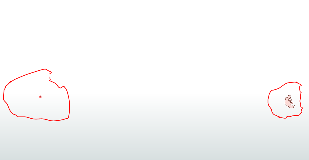
Hello There I have 2 polygons, as you can see on the inspector both are into different location
all using projected coordinate when we using the clipper it inside results
how this is possible


 +10
+10
Hello There I have 2 polygons, as you can see on the inspector both are into different location
all using projected coordinate when we using the clipper it inside results
how this is possible


 +30
+30
Hi @boubcher
I saw that the Reader Parcel.shp has the coordinate UTM84-37N and the other Source Boundary.shp has the coordinate UTM84-38N.
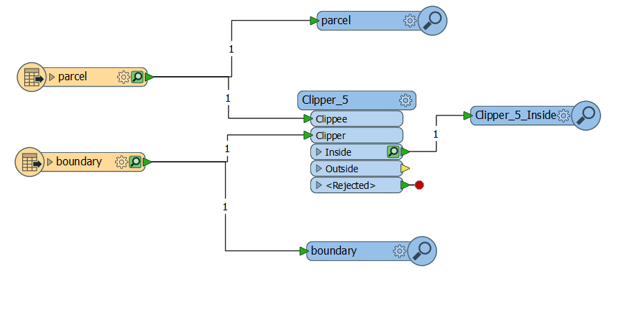
When I executed the Workspace the Source data:
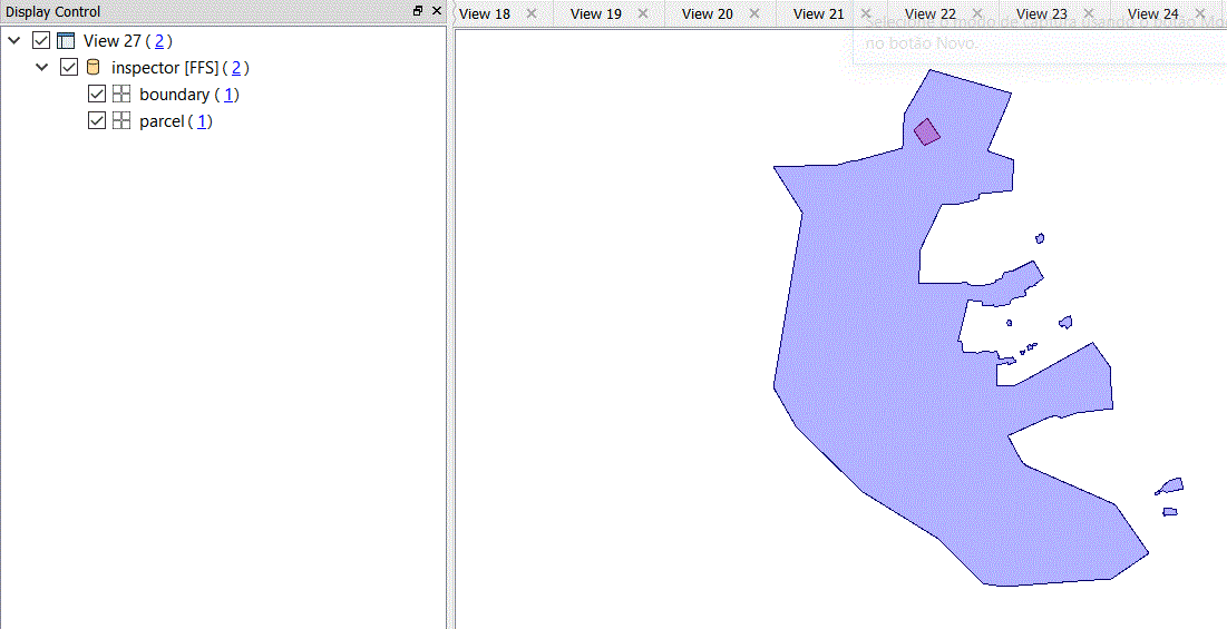
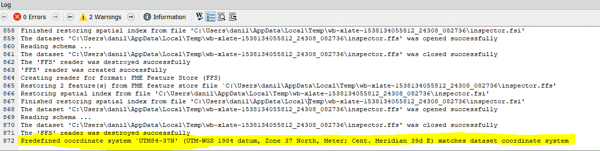
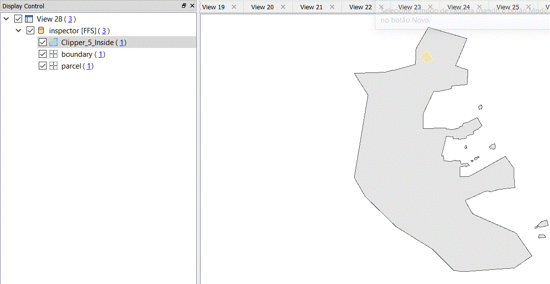
The LOg File Inspector show this about the coordinate system predefined in FME Data Inspector:
The Result of Clipper Transformer:
Thanks,
Danilo
+10
Hi @boubcher
I saw that the Reader Parcel.shp has the coordinate UTM84-37N and the other Source Boundary.shp has the coordinate UTM84-38N.
When I executed the Workspace the Source data:
The LOg File Inspector show this about the coordinate system predefined in FME Data Inspector:
The Result of Clipper Transformer:
Thanks,
Danilo
then the clipper is right and the problem is the viewer ? showing the parcle into the wrong place ?
+10
Hi @boubcher
I saw that the Reader Parcel.shp has the coordinate UTM84-37N and the other Source Boundary.shp has the coordinate UTM84-38N.
When I executed the Workspace the Source data:
The LOg File Inspector show this about the coordinate system predefined in FME Data Inspector:
The Result of Clipper Transformer:
Thanks,
Danilo
@danilo_fme
when you add a bing background Map , then the pacel is completely out side could you explain
Thanks
+30
@danilo_fme
when you add a bing background Map , then the pacel is completely out side could you explain
Thanks
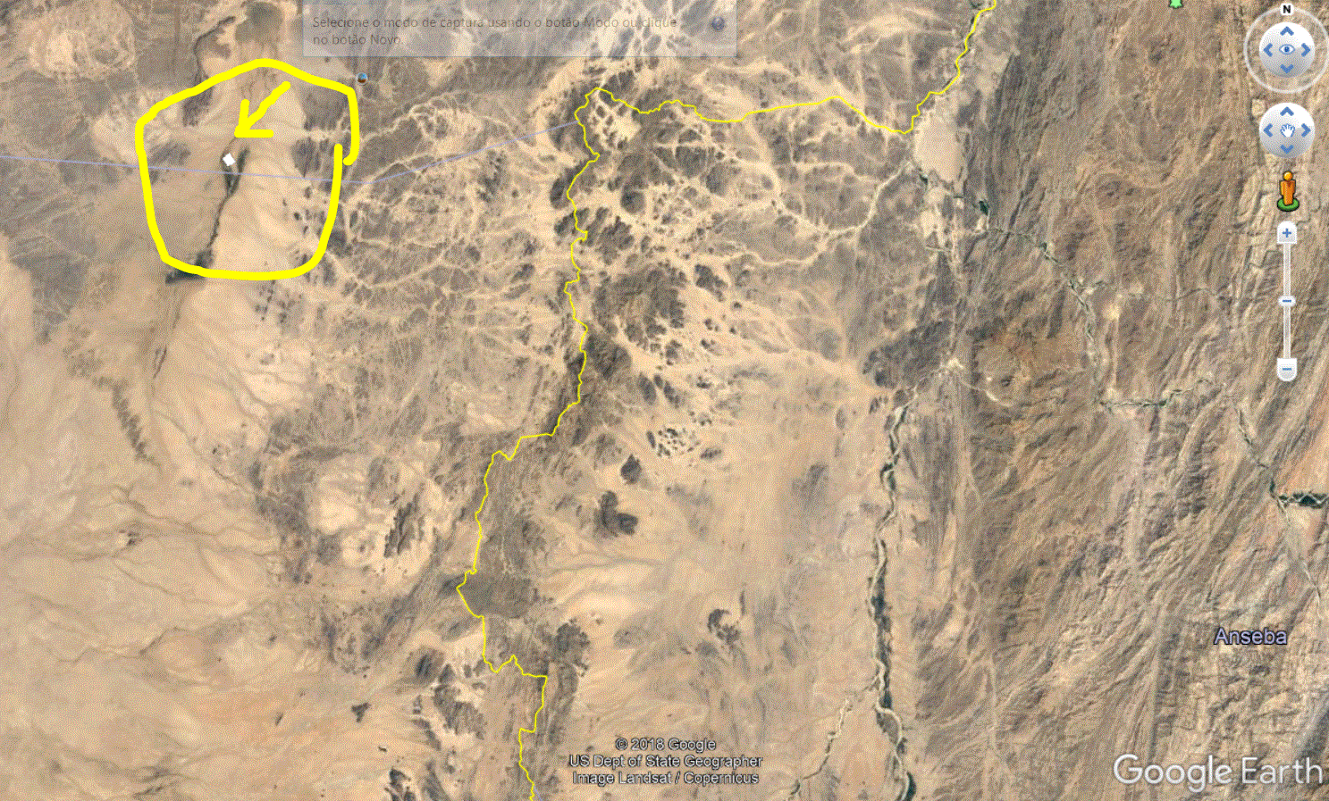
I generated a Writer KML and the result in Google Earth:

 +17
+17
Hi @boubcher, as @danilo_fme mentioned, the parcel and the boundary have different coordinate systems.
If the coordinate systems defined in the datasets are correct, those geometries don't intersect geographically. However, the Clipper just treats input features as geometric shapes without considering their coordinate systems, so the boundary would be clipped by the parcel. I think that's the situation you have observed.
If you need to perform clipping operation correctly according to geographic spatial relations, you will have to reproject the features into the same coordinate system beforehand.
+10
Hi @boubcher, as @danilo_fme mentioned, the parcel and the boundary have different coordinate systems.
If the coordinate systems defined in the datasets are correct, those geometries don't intersect geographically. However, the Clipper just treats input features as geometric shapes without considering their coordinate systems, so the boundary would be clipped by the parcel. I think that's the situation you have observed.
If you need to perform clipping operation correctly according to geographic spatial relations, you will have to reproject the features into the same coordinate system beforehand.
both are in a projected coordinate system one is in zoon 37 and other 38 ,
to get accurate result cliping opration should be done on project object , and this is our case
am I missing anything ?
+17
Hi @boubcher, as @danilo_fme mentioned, the parcel and the boundary have different coordinate systems.
If the coordinate systems defined in the datasets are correct, those geometries don't intersect geographically. However, the Clipper just treats input features as geometric shapes without considering their coordinate systems, so the boundary would be clipped by the parcel. I think that's the situation you have observed.
If you need to perform clipping operation correctly according to geographic spatial relations, you will have to reproject the features into the same coordinate system beforehand.
+30
both are in a projected coordinate system one is in zoon 37 and other 38 ,
to get accurate result cliping opration should be done on project object , and this is our case
am I missing anything ?
mentioned here in Brazil for example We have region with 3 different zones in the same State. In this project we reproject these 3 zones for the same coordinate system.
+10
Hi @boubcher, as @danilo_fme mentioned, the parcel and the boundary have different coordinate systems.
If the coordinate systems defined in the datasets are correct, those geometries don't intersect geographically. However, the Clipper just treats input features as geometric shapes without considering their coordinate systems, so the boundary would be clipped by the parcel. I think that's the situation you have observed.
If you need to perform clipping operation correctly according to geographic spatial relations, you will have to reproject the features into the same coordinate system beforehand.
@takashi
if you remove the background Map, both will even with 2 diffrent projected coordinate overlap, and in the reel world they overlap
but when you add the background map, the parcel is not in the same place
if its projection problem the should not overlay even when we remove the background map
just trying to understand why is that
+17
Hi @boubcher, as @danilo_fme mentioned, the parcel and the boundary have different coordinate systems.
If the coordinate systems defined in the datasets are correct, those geometries don't intersect geographically. However, the Clipper just treats input features as geometric shapes without considering their coordinate systems, so the boundary would be clipped by the parcel. I think that's the situation you have observed.
If you need to perform clipping operation correctly according to geographic spatial relations, you will have to reproject the features into the same coordinate system beforehand.
Enter your username or e-mail address. We'll send you an e-mail with instructions to reset your password.

