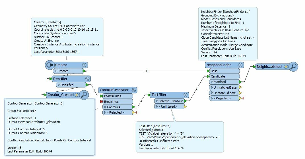
Return XY coordinate of certain Z value along polyline Z
This is not a measure along the line. Measure might be 11200', but z is 10900'. Also, vertices are every 100' or so -- not easy to interpolate to the exact Z via converting the line to vertices. I want to avoid going too complex with this solution -- is there an easy way that is escaping me?