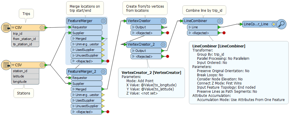
First, I apologize if this is very basic, but I can't seem to find out how to make this work. Additionally, I'm very new to FME so I'm learning as I'm going. This data is about a bike sharing program.
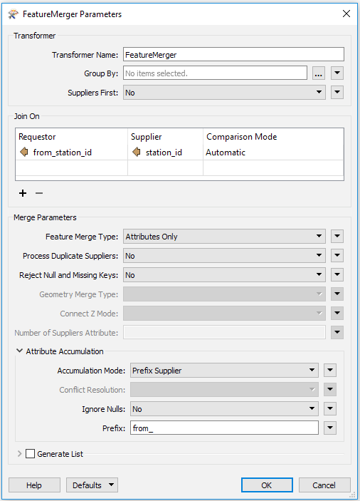
I have two CSVs, one contains the station IDs with Lat / Long, the other contains the trip information. Here are some of the columns (I've removed all the others for this question)
Station File:
station_id latitude longitude
Trip File:
trip_id from_station_id to_station_idWhat I would like to go is add them to a (Geo?)JSON file, so each TRIP_ID contains a polyline geometry of the FROM and TO locations.
How would I got about doing this?
Best answer by daveatsafe
View original