I am trying to convert some DEM in .tif image to polygon geometries representing 3 dimensional triangles that is Well-known text (WKT) - 3D (x, y, z) .
What is the work flow for doing this?
Best answer by takashi
View original
I am trying to convert some DEM in .tif image to polygon geometries representing 3 dimensional triangles that is Well-known text (WKT) - 3D (x, y, z) .
What is the work flow for doing this?
Best answer by takashi
View original
 +17
+17
You can use the TINGenerator to create triangles (3D polygons) from a single band numeric raster and use the GeometryExtractor to extract WKT representation as a feature attribute for each triangle.
You can use the TINGenerator to create triangles (3D polygons) from a single band numeric raster and use the GeometryExtractor to extract WKT representation as a feature attribute for each triangle.
@takashi, thank you for your support.
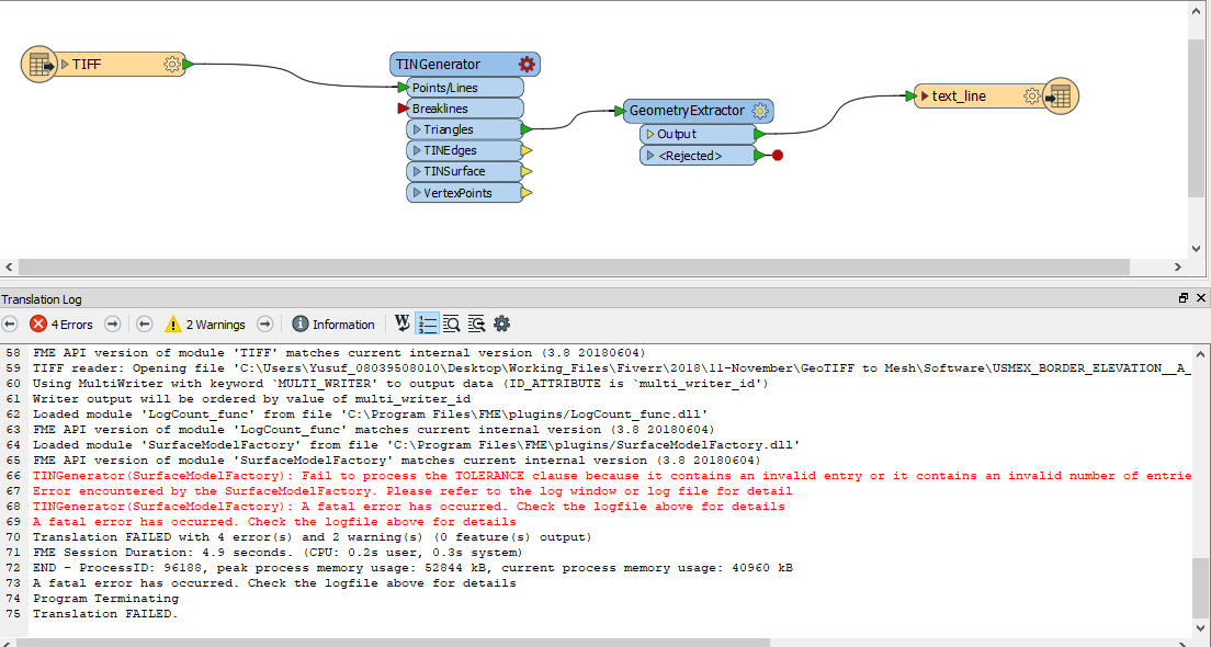
I appears am not getting is right as there is no output produced. See me screen below.... What am I missing?
+17
You can use the TINGenerator to create triangles (3D polygons) from a single band numeric raster and use the GeometryExtractor to extract WKT representation as a feature attribute for each triangle.
The red cogwheel icon on a transformer GUI indicates that one or more required parameters are not set yet. Probably you didn't set the Surface Tolerance parameter. Try setting 0 or greater value to the parameter.
You can use the TINGenerator to create triangles (3D polygons) from a single band numeric raster and use the GeometryExtractor to extract WKT representation as a feature attribute for each triangle.
I am new to this technology unfortunately, I couldn't get this to work.
Permit me to ask for a detailed step-by-step guide on doing it? GeoTiff to 3D WKT

 +2
+2
I am new to this technology unfortunately, I couldn't get this to work.
Permit me to ask for a detailed step-by-step guide on doing it? GeoTiff to 3D WKT
@shintaku Would you mind attache your workspace as it is now? That way the community experts can help you debug what's missing and how to get it to work. Thanks!
+17
You can use the TINGenerator to create triangles (3D polygons) from a single band numeric raster and use the GeometryExtractor to extract WKT representation as a feature attribute for each triangle.
Possibly you've not made a connection between the attribute storing OGC WKT and the attribute "text_line_data" in the destination Text File writer feature type yet.
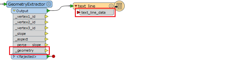
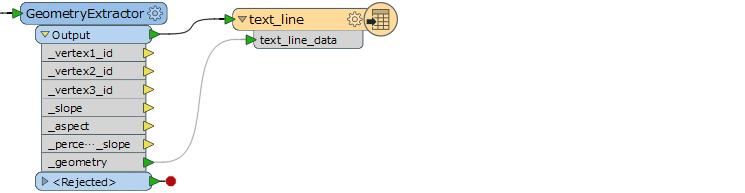
There are three ways to make the connection.
1. Just drag to draw a link between them.
2. Rename the geometry attribute to the same name as the destination attribute, in the GeometryExtractor parameters dialog.
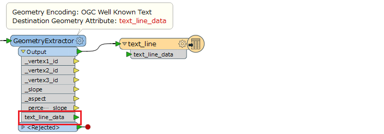
3. Set the geometry attribute to the destination attribute in the writer feature type.
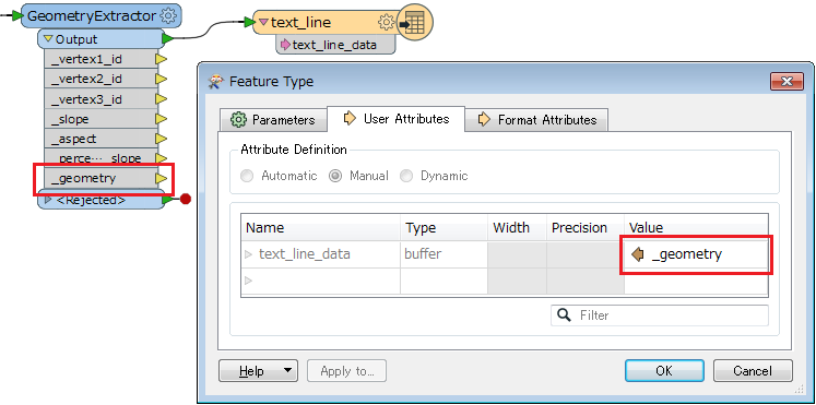
Hope this helps.
Enter your username or e-mail address. We'll send you an e-mail with instructions to reset your password.

