Question

A point was encountered that was enclosed in more than one polygon

  • 14 November 2014
  • 2 replies
  • 10 views

hello, I need help seriously~


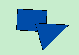
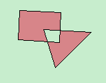
I have two polygon layers, one is a layer containing many countries (here I name it Country Layer), another contains a multi-part polygon which represents protected areas (here I name it Protected Layer, and this is the result of Aggregator operation of many polygons represnt protected areas in FME)~


My purpose is to clip the Country Layer to the Protected Layer to get protected areas in each country (In Clipper operation of FME, the clipper is my Country Layer, the clippee is my Protected Area)~


In my data processing of clipper, sometimes it does work,  but sometimes it fails(Because I have serveral layers of protected area represnting different years, and several Country Layers to represent different types of countries ).


The Major Error is Invalid Topology, but I don't know what it exactly means: which rule it violates? Because before this operation, I have used Check geometry and Repair geometry in ArcGIS to avoid some errors such self-intersection.


And even when the clipper operation works, it always give a warning message: A point was encountered that was enclosed in more than one polygon. However, I don't even have a point layer, two layers in my data processing is both polygon features in geodatabase. So I am very confused. 


Does anybody confronts similar situation or know how to resolve this problem? Thank you very much. 


LuLu

2 replies

Userlevel 2
Badge +17
Hi LuLu,


Regarding the major error, I cannot specify exact situation from the limited information. What kind of error message has appeared in the log when the workspace fell?


Regarding the warning, I guess the reason is that there are overlapping areas among adjoining clipper polygons.


Takashi
hi, Takashi~


I'm very appreciate to your apply~


After my test, I knew it's the aggregator operation generates some self-intersection problems. 


In my test, I generate a Polygon Layer which contains some small polygons, and some are overlapped(here we name it as Layer A), then I use dissolve operation in ArcGIS to dissolve these polygons(here we name it as Layer B), next I use the aggregator operation in FME to aggregator all polygons(here we name it as Layer C). 


Then I check geometry for Layer B and Layer C. Layer B is ok, having no genometry problems, whereas the Layer C has self-intersection problem. 


And when I look into Layer B and Layer C, I found that in Layer B, all the polygons is dissolved, including those overlapping parts. However, in Layer C, those overlapping parts are ignored. (The pictude is as follows:) 


So, is the aggregator operation in FME doesn't equal to the dissolve operation in ArcGIS? If so, are there any similar operations I can use in FME which considering these overlapping parts when dissolving? 


Reply