Hello,
I am writing to ESRI geodatabase that uses MS SQL. Every time I get "Unable to convert value taken from Z_ORIGIN keyword to a float data type".
So far i have:
- Used a 2dforcer,
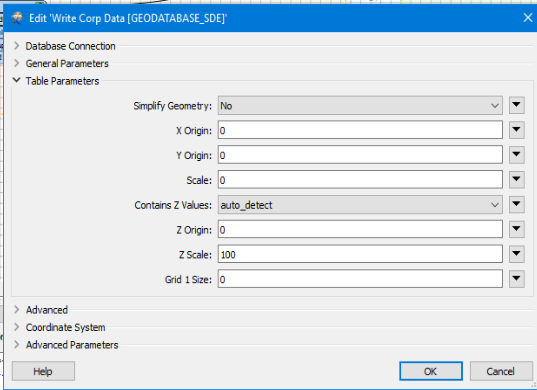
- changed the "z scale and z origin" to 0 or 0.00000
- under table creation parameters set "Contains Z Values" to No (also set to yes, and blank on other trys)
- Recreated the writers
- Set the writer geometry to table, not a point file.
Nothing has worked. I am under the assumption that the writer is passing a "Null" value to the writer which in turn says that "null" cant be a float value.
Finally I have looked at the other posts on this and nothing has helped. Any suggestions?
Just to update, I used a vertex creator to make new geometry, and still didn't work, but i can insert all of this into a file geodatabase and then import that to my enterprise database. If anyone has any help please post it, this issue doesn't have a good answer on the forms yet.


")