Solved

How can I change the Vertical Datum (Vertically Reproject) in a Raster DEM

  • 28 February 2018
  • 1 reply
  • 34 views

Userlevel 4
Badge +13

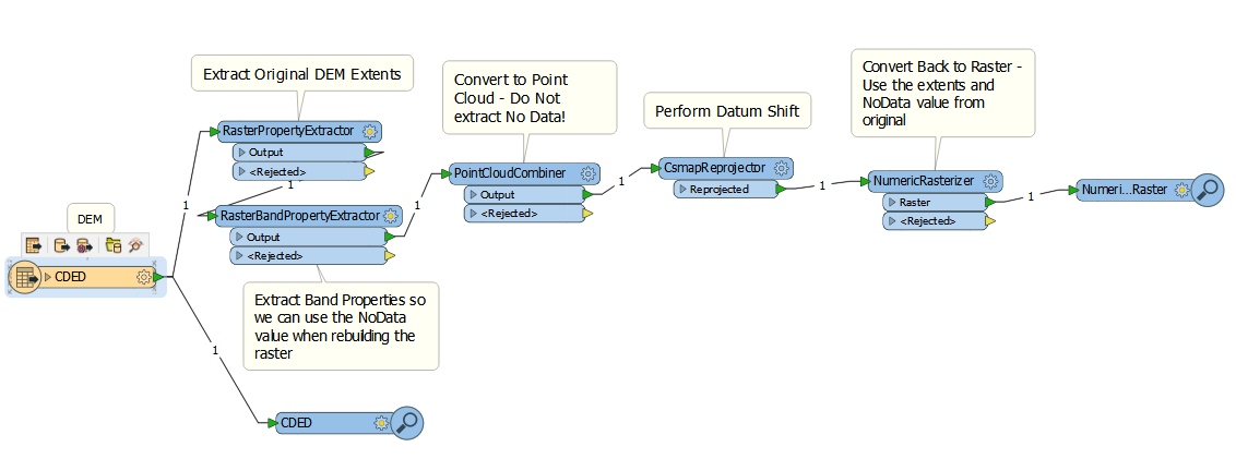
I have a raster in which I need to change the vertical datum. I tried using the CSMapReprojector but it didn't work. It looks like FME just always sees the Raster at 2D when I view it in the Data Inspector. Is this a bug?

icon

Best answer by fmelizard 28 February 2018, 19:42

View original

1 reply

Userlevel 4
Badge +13

This is not a bug. FME will always interpret a raster as 2D. The height information is stored in the pixels of the raster image. To shift the vertical datum it's probably easiest to first convert it to a Point Cloud, then perform the vertical shift and then change it back into a Raster.

You can try it your self here: reprojectrasterheights.fmwt


(Data sourced from the City of Vancouver)

Reply