Question

Python FME Objects API for Raster Manipulation

  • 24 December 2016
  • 22 replies
  • 31 views

Userlevel 2
Badge +17

This is a fantastic Christmas present. Thank you very much!

Where can we access the documentation on the API?

======================= FME 2017.0 "What's New" =======================

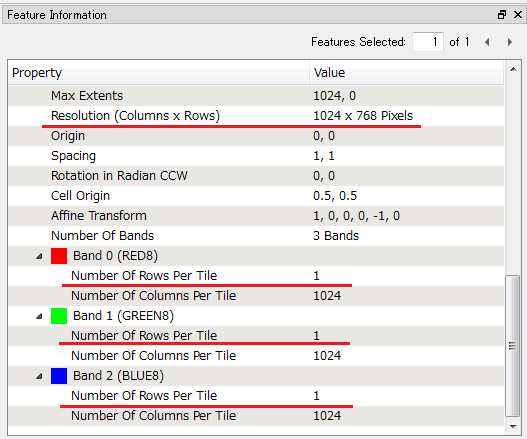
------------------------- FME 2017.0 17217 20161221 -------------------------FME Objects Python: Added Python Raster API. (PR 50880). C86032 C88501 C88502 C93631 C107415 C120839

[Edit] OK. I found the doc in the FME 2017.0 beta build 17217 install directory :-)

<FME 2017 HOME>/fmeobjects/python/apidoc/index.html

fmeobjects.FMEBand / FMEBandProperties/ FMEBandTilePopulator / FMEPalette / FMERaster / FMERasterProperties / FMERasterTools / FMETile


22 replies

Userlevel 4
Badge +13

Glad you found it. Merry Christmas! We're excited to open up raster manipulation to the Pythonistas out there. Bonus -- you can use either Python 3.x or 2.x as well!

Userlevel 4

Wow, yes this is wonderful news!

Userlevel 4
Badge +30

Amazing.

I will use it!

Userlevel 2
Badge +17

I would share my first exercise to learn how to create a new raster geometry with the API.

# PythonCreator Script Example: Create a Feature containing a Raster
# The raster will have a single band with UINT8 interpretation.
import fmeobjects

# Define a concrete class derived from FMEBandTilePopulator class.
# An instance of this class will be used to create a tile
# and populate it to a band (FMEBand instance).
class MyUInt8BandTilePopulator(fmeobjects.FMEBandTilePopulator):
    def __init__(self, dataArray):
        self.dataArray = dataArray
        
    # Implement 'clone' method.
    # It will be called multiple times while creating a new band.
    def clone(self):
        return MyUInt8BandTilePopulator(self.dataArray)
        
    # Implement 'getTile' method.
    # You can create a new tile containing desired contents here.
    # It's not essential to use the parameters: startRow, startCol, tile.
    def getTile(self, startRow, startCol, tile):
        numRows, numCols = len(self.dataArray), len(self.dataArray[0])
        newTile = fmeobjects.FMEUInt8Tile(numRows, numCols)
        newTile.setData(self.dataArray)      
        return newTile
        
    # The following two methods won't be called while creating a new band.
    # It seems not to be essential to implement these methods in this case,
    # although the API doc says "This method must be implemented
    # in the FMEBandTilePopulator subclass".
    def setDeleteSourceOnDestroy(self, deleteFlag):
        pass
    def setOutputSize(self, rows, cols):
        return (rows, cols)
        
class FeatureCreator(object):
    def __init__(self):
        pass
        
    def close(self):
        # Contents of a tile for a band to be created.
        # A list of row data, each element is a list of column values.
        dataArray = [
            [  0, 128,   0, 128,   0, 128,   0],
            [128,   0, 128,   0, 128,   0, 128],
            [  0, 128,   0, 128,   0, 128,   0],
            [128,   0, 128,   0, 128,   0, 128],
            [  0, 128,   0, 128,   0, 128,   0],
        ]
        
        # Properties of a raster to be created.
        numRows, numCols = len(dataArray), len(dataArray[0]) # resolution
        xSpacing, ySpacing = 10.0, 10.0 # cell spacing in ground units
        xCellOrigin, yCellOrigin = 0.5, 0.5 # cell origin coordinates
        xOrigin, yOrigin = 0.0, numRows * ySpacing # left-top coordinates
        xRotation, yRotation = 0.0, 0.0 # rotation angle in degrees
        
        # Create a new raster.
        rasterProperties = fmeobjects.FMERasterProperties(numRows, numCols,
            xSpacing, ySpacing, xCellOrigin, yCellOrigin, xOrigin, yOrigin,
            xRotation, yRotation)
        raster = fmeobjects.FMERaster(rasterProperties)
        
        # Create a new band and append it to the raster.
        # It's optional to specify Nodata value when creating a band.
        bandTilePopulator = MyUInt8BandTilePopulator(dataArray)
        bandName = 'My UInt8 Band' # can be set to empty.
        bandProperties = fmeobjects.FMEBandProperties(bandName,
            fmeobjects.FME_INTERPRETATION_UINT8,
            fmeobjects.FME_TILE_TYPE_FIXED,
            numRows, numCols)
        nodataValue = fmeobjects.FMEUInt8Tile(1, 1)
        nodataValue.setData([[0]])
        band = fmeobjects.FMEBand(bandTilePopulator,
            rasterProperties, bandProperties, nodataValue)
        raster.appendBand(band)
        
        # Create and output a feature containing the raster created above.
        feature = fmeobjects.FMEFeature()
        feature.setGeometry(raster)
        self.pyoutput(feature)

Userlevel 4

I would share my first exercise to learn how to create a new raster geometry with the API.

# PythonCreator Script Example: Create a Feature containing a Raster
# The raster will have a single band with UINT8 interpretation.
import fmeobjects

# Define a concrete class derived from FMEBandTilePopulator class.
# An instance of this class will be used to create a tile
# and populate it to a band (FMEBand instance).
class MyUInt8BandTilePopulator(fmeobjects.FMEBandTilePopulator):
    def __init__(self, dataArray):
        self.dataArray = dataArray
        
    # Implement 'clone' method.
    # It will be called multiple times while creating a new band.
    def clone(self):
        return MyUInt8BandTilePopulator(self.dataArray)
        
    # Implement 'getTile' method.
    # You can create a new tile containing desired contents here.
    # It's not essential to use the parameters: startRow, startCol, tile.
    def getTile(self, startRow, startCol, tile):
        numRows, numCols = len(self.dataArray), len(self.dataArray[0])
        newTile = fmeobjects.FMEUInt8Tile(numRows, numCols)
        newTile.setData(self.dataArray)      
        return newTile
        
    # The following two methods won't be called while creating a new band.
    # It seems not to be essential to implement these methods in this case,
    # although the API doc says "This method must be implemented
    # in the FMEBandTilePopulator subclass".
    def setDeleteSourceOnDestroy(self, deleteFlag):
        pass
    def setOutputSize(self, rows, cols):
        return (rows, cols)
        
class FeatureCreator(object):
    def __init__(self):
        pass
        
    def close(self):
        # Contents of a tile for a band to be created.
        # A list of row data, each element is a list of column values.
        dataArray = [
            [  0, 128,   0, 128,   0, 128,   0],
            [128,   0, 128,   0, 128,   0, 128],
            [  0, 128,   0, 128,   0, 128,   0],
            [128,   0, 128,   0, 128,   0, 128],
            [  0, 128,   0, 128,   0, 128,   0],
        ]
        
        # Properties of a raster to be created.
        numRows, numCols = len(dataArray), len(dataArray[0]) # resolution
        xSpacing, ySpacing = 10.0, 10.0 # cell spacing in ground units
        xCellOrigin, yCellOrigin = 0.5, 0.5 # cell origin coordinates
        xOrigin, yOrigin = 0.0, numRows * ySpacing # left-top coordinates
        xRotation, yRotation = 0.0, 0.0 # rotation angle in degrees
        
        # Create a new raster.
        rasterProperties = fmeobjects.FMERasterProperties(numRows, numCols,
            xSpacing, ySpacing, xCellOrigin, yCellOrigin, xOrigin, yOrigin,
            xRotation, yRotation)
        raster = fmeobjects.FMERaster(rasterProperties)
        
        # Create a new band and append it to the raster.
        # It's optional to specify Nodata value when creating a band.
        bandTilePopulator = MyUInt8BandTilePopulator(dataArray)
        bandName = 'My UInt8 Band' # can be set to empty.
        bandProperties = fmeobjects.FMEBandProperties(bandName,
            fmeobjects.FME_INTERPRETATION_UINT8,
            fmeobjects.FME_TILE_TYPE_FIXED,
            numRows, numCols)
        nodataValue = fmeobjects.FMEUInt8Tile(1, 1)
        nodataValue.setData([[0]])
        band = fmeobjects.FMEBand(bandTilePopulator,
            rasterProperties, bandProperties, nodataValue)
        raster.appendBand(band)
        
        # Create and output a feature containing the raster created above.
        feature = fmeobjects.FMEFeature()
        feature.setGeometry(raster)
        self.pyoutput(feature)

Nice! Thanks for sharing!
Userlevel 4
Badge +30

I would share my first exercise to learn how to create a new raster geometry with the API.

# PythonCreator Script Example: Create a Feature containing a Raster
# The raster will have a single band with UINT8 interpretation.
import fmeobjects

# Define a concrete class derived from FMEBandTilePopulator class.
# An instance of this class will be used to create a tile
# and populate it to a band (FMEBand instance).
class MyUInt8BandTilePopulator(fmeobjects.FMEBandTilePopulator):
    def __init__(self, dataArray):
        self.dataArray = dataArray
        
    # Implement 'clone' method.
    # It will be called multiple times while creating a new band.
    def clone(self):
        return MyUInt8BandTilePopulator(self.dataArray)
        
    # Implement 'getTile' method.
    # You can create a new tile containing desired contents here.
    # It's not essential to use the parameters: startRow, startCol, tile.
    def getTile(self, startRow, startCol, tile):
        numRows, numCols = len(self.dataArray), len(self.dataArray[0])
        newTile = fmeobjects.FMEUInt8Tile(numRows, numCols)
        newTile.setData(self.dataArray)      
        return newTile
        
    # The following two methods won't be called while creating a new band.
    # It seems not to be essential to implement these methods in this case,
    # although the API doc says "This method must be implemented
    # in the FMEBandTilePopulator subclass".
    def setDeleteSourceOnDestroy(self, deleteFlag):
        pass
    def setOutputSize(self, rows, cols):
        return (rows, cols)
        
class FeatureCreator(object):
    def __init__(self):
        pass
        
    def close(self):
        # Contents of a tile for a band to be created.
        # A list of row data, each element is a list of column values.
        dataArray = [
            [  0, 128,   0, 128,   0, 128,   0],
            [128,   0, 128,   0, 128,   0, 128],
            [  0, 128,   0, 128,   0, 128,   0],
            [128,   0, 128,   0, 128,   0, 128],
            [  0, 128,   0, 128,   0, 128,   0],
        ]
        
        # Properties of a raster to be created.
        numRows, numCols = len(dataArray), len(dataArray[0]) # resolution
        xSpacing, ySpacing = 10.0, 10.0 # cell spacing in ground units
        xCellOrigin, yCellOrigin = 0.5, 0.5 # cell origin coordinates
        xOrigin, yOrigin = 0.0, numRows * ySpacing # left-top coordinates
        xRotation, yRotation = 0.0, 0.0 # rotation angle in degrees
        
        # Create a new raster.
        rasterProperties = fmeobjects.FMERasterProperties(numRows, numCols,
            xSpacing, ySpacing, xCellOrigin, yCellOrigin, xOrigin, yOrigin,
            xRotation, yRotation)
        raster = fmeobjects.FMERaster(rasterProperties)
        
        # Create a new band and append it to the raster.
        # It's optional to specify Nodata value when creating a band.
        bandTilePopulator = MyUInt8BandTilePopulator(dataArray)
        bandName = 'My UInt8 Band' # can be set to empty.
        bandProperties = fmeobjects.FMEBandProperties(bandName,
            fmeobjects.FME_INTERPRETATION_UINT8,
            fmeobjects.FME_TILE_TYPE_FIXED,
            numRows, numCols)
        nodataValue = fmeobjects.FMEUInt8Tile(1, 1)
        nodataValue.setData([[0]])
        band = fmeobjects.FMEBand(bandTilePopulator,
            rasterProperties, bandProperties, nodataValue)
        raster.appendBand(band)
        
        # Create and output a feature containing the raster created above.
        feature = fmeobjects.FMEFeature()
        feature.setGeometry(raster)
        self.pyoutput(feature)


Cool @takashi... That is very important for us that we love Python and FME.
Userlevel 2
Badge +17

The second exercise: Calculate cell values, append a palette to the band, and try a raster tool. From the Conway's Game of Life.

FME Challenge: The Game of Life

# PythonCaller Script Example: Conway's Game of Life
# FME 2017.0 RC build 17254, 2017-02-28
# Each of the output features contains a raster representing live/dead cells.
# The raster has a single band and the band has a palette.
# Assuming that the input feature has these attributes.
# 1. numGenerations (0 < integer): The number of generations to be processed.
# 2. numRows (0 < integer): The number of rows in the resulting raster.
# 3. numCols (0 < integer): The number of columns in in the resulting raster.
# 4. initialRate (0 < real < 1): The rate of alive cells in the first generation.
# A new attribute called '_generation' will be added to the output features,
# which stores 1-based sequential number indicating the order of the generation.
import fmeobjects, random

class MyUInt8BandTilePopulator(fmeobjects.FMEBandTilePopulator):
    def __init__(self, dataArray):
        self.dataArray = dataArray
        
    def clone(self):
        return MyUInt8BandTilePopulator(self.dataArray)
        
    def getTile(self, startRow, startCol, tile):
        numRows, numCols = len(self.dataArray), len(self.dataArray[0])
        newTile = fmeobjects.FMEUInt8Tile(numRows, numCols)
        newTile.setData(self.dataArray)      
        return newTile

class ConwaysGameOfLife(object):
    def __init__(self):
        self.rasterTools = fmeobjects.FMERasterTools()
    
    def input(self, feature):
        # Get parameters from feature attributes.
        numGenerations = int(feature.getAttribute('numGenerations'))
        self.numRows = int(feature.getAttribute('numRows'))
        self.numCols = int(feature.getAttribute('numCols'))
        self.initialRate = float(feature.getAttribute('initialRate'))
        
        if 0 < numGenerations \
           and 0 < self.numRows and 0 < self.numCols \
           and 0.0 <= self.initialRate and self.initialRate <= 1.0:
            self.initialize()
            outNumRows, outNumCols = self.numRows * 10, self.numCols * 10
            raster = None
            for i in range(numGenerations):
                raster = self.nextGeneration(raster)
                feature.setGeometry(self.rasterTools.resampleByRowCol(
                    outNumRows, outNumCols,
                    fmeobjects.FME_INTERPOLATION_NEARESTNEIGHBOR, raster))
                feature.setAttribute('_generation', i + 1)
                self.pyoutput(feature)
        else:
            feature.setAttribute('_error', 'invalid parameter')
            self.pyputout(feature)
            
    def initialize(self):
        # Raster properties
        xSpacing, ySpacing = 1.0, 1.0
        xCellOrigin, yCellOrigin = 0.5, 0.5
        xOrigin, yOrigin = 0.0, 0.0
        xRotation, yRotation = 0.0, 0.0
        self.rasterProperties = fmeobjects.FMERasterProperties(
            self.numRows, self.numCols,
            xSpacing, ySpacing, xCellOrigin, yCellOrigin, xOrigin, yOrigin,
            xRotation, yRotation)

        # Band properties            
        self.bandProperties = fmeobjects.FMEBandProperties(
            'Game of Life',
            fmeobjects.FME_INTERPRETATION_UINT8,
            fmeobjects.FME_TILE_TYPE_FIXED,
            self.numRows, self.numCols)
            
        # Create a Palette object representing:
        # --------------------
        # RGB24
        # 0 220,220,220
        # 1 128,0,0
        # --------------------
        key = fmeobjects.FMEUInt8Tile(1, 2)
        key.setData([[0, 1]])
        value = fmeobjects.FMERGB24Tile(1, 2)
        value.setData([[
            220,220,220,
            128,0,0,
        ]])
        self.palette = fmeobjects.FMEPalette('', key, value)

    # Return a raster representing the next generation,
    # or the first generation if the argument was None.
    def nextGeneration(self, prevRaster):
        nextData = []
        if prevRaster == None:
            num = self.numRows * self.numCols
            alives = int(num * self.initialRate)
            seed = [1 for i in range(alives)] + [0 for i in range(num - alives)]
            random.shuffle(seed)
            for s in [i * self.numCols for i in range(self.numRows)]:
                nextData.append(seed[s:s + self.numCols])
        else:
            # Get the data array of the previous generation.
            tile = fmeobjects.FMEUInt8Tile(self.numRows, self.numCols)
            prevData = prevRaster.getBand(0).getTile(0, 0, tile).getData()
            
            # Create a temporary data array whose size is enlarged one row/column
            # per each edge - top, bottom, left, and right of the previous raster,
            # and set 0 to all the additional outer edge cells.
            # This data array makes it easy to compute the number of neighbor cells
            # alive in the previous generation for each cell. 
            tmp = [[0 for i in range(self.numCols + 2)]] \
                + [[0] + data + [0] for data in prevData] \
                + [[0 for i in range(self.numCols + 2)]]
                
            # Create a new data array for the next generation.
            for i in range(self.numRows):
                row = []
                for j in range(self.numCols):
                    # Compute the number of neighbor cells alive in the previous
                    # generation, and then determine if the cell can be alive
                    # in the next generation according to the rules of the game.
                    n = tmp[i+0][j] + tmp[i+0][j+1] + tmp[i+0][j+2] \
                      + tmp[i+1][j]                 + tmp[i+1][j+2] \
                      + tmp[i+2][j] + tmp[i+2][j+1] + tmp[i+2][j+2]
                    if prevData[i][j] == 1:
                        row.append(1 if n in [2, 3] else 0)
                    else:
                        row.append(1 if n == 3 else 0)
                nextData.append(row)
                
        # Create and return a raster containing a single band.
        raster = fmeobjects.FMERaster(self.rasterProperties)
        band = fmeobjects.FMEBand(MyUInt8BandTilePopulator(nextData),
            self.rasterProperties, self.bandProperties)
        band.appendPalette(self.palette) # Add a palette to the band.
        raster.appendBand(band)
        return raster

Userlevel 4

The second exercise: Calculate cell values, append a palette to the band, and try a raster tool. From the Conway's Game of Life.

FME Challenge: The Game of Life

# PythonCaller Script Example: Conway's Game of Life
# FME 2017.0 RC build 17254, 2017-02-28
# Each of the output features contains a raster representing live/dead cells.
# The raster has a single band and the band has a palette.
# Assuming that the input feature has these attributes.
# 1. numGenerations (0 < integer): The number of generations to be processed.
# 2. numRows (0 < integer): The number of rows in the resulting raster.
# 3. numCols (0 < integer): The number of columns in in the resulting raster.
# 4. initialRate (0 < real < 1): The rate of alive cells in the first generation.
# A new attribute called '_generation' will be added to the output features,
# which stores 1-based sequential number indicating the order of the generation.
import fmeobjects, random

class MyUInt8BandTilePopulator(fmeobjects.FMEBandTilePopulator):
    def __init__(self, dataArray):
        self.dataArray = dataArray
        
    def clone(self):
        return MyUInt8BandTilePopulator(self.dataArray)
        
    def getTile(self, startRow, startCol, tile):
        numRows, numCols = len(self.dataArray), len(self.dataArray[0])
        newTile = fmeobjects.FMEUInt8Tile(numRows, numCols)
        newTile.setData(self.dataArray)      
        return newTile

class ConwaysGameOfLife(object):
    def __init__(self):
        self.rasterTools = fmeobjects.FMERasterTools()
    
    def input(self, feature):
        # Get parameters from feature attributes.
        numGenerations = int(feature.getAttribute('numGenerations'))
        self.numRows = int(feature.getAttribute('numRows'))
        self.numCols = int(feature.getAttribute('numCols'))
        self.initialRate = float(feature.getAttribute('initialRate'))
        
        if 0 < numGenerations \
           and 0 < self.numRows and 0 < self.numCols \
           and 0.0 <= self.initialRate and self.initialRate <= 1.0:
            self.initialize()
            outNumRows, outNumCols = self.numRows * 10, self.numCols * 10
            raster = None
            for i in range(numGenerations):
                raster = self.nextGeneration(raster)
                feature.setGeometry(self.rasterTools.resampleByRowCol(
                    outNumRows, outNumCols,
                    fmeobjects.FME_INTERPOLATION_NEARESTNEIGHBOR, raster))
                feature.setAttribute('_generation', i + 1)
                self.pyoutput(feature)
        else:
            feature.setAttribute('_error', 'invalid parameter')
            self.pyputout(feature)
            
    def initialize(self):
        # Raster properties
        xSpacing, ySpacing = 1.0, 1.0
        xCellOrigin, yCellOrigin = 0.5, 0.5
        xOrigin, yOrigin = 0.0, 0.0
        xRotation, yRotation = 0.0, 0.0
        self.rasterProperties = fmeobjects.FMERasterProperties(
            self.numRows, self.numCols,
            xSpacing, ySpacing, xCellOrigin, yCellOrigin, xOrigin, yOrigin,
            xRotation, yRotation)

        # Band properties            
        self.bandProperties = fmeobjects.FMEBandProperties(
            'Game of Life',
            fmeobjects.FME_INTERPRETATION_UINT8,
            fmeobjects.FME_TILE_TYPE_FIXED,
            self.numRows, self.numCols)
            
        # Create a Palette object representing:
        # --------------------
        # RGB24
        # 0 220,220,220
        # 1 128,0,0
        # --------------------
        key = fmeobjects.FMEUInt8Tile(1, 2)
        key.setData([[0, 1]])
        value = fmeobjects.FMERGB24Tile(1, 2)
        value.setData([[
            220,220,220,
            128,0,0,
        ]])
        self.palette = fmeobjects.FMEPalette('', key, value)

    # Return a raster representing the next generation,
    # or the first generation if the argument was None.
    def nextGeneration(self, prevRaster):
        nextData = []
        if prevRaster == None:
            num = self.numRows * self.numCols
            alives = int(num * self.initialRate)
            seed = [1 for i in range(alives)] + [0 for i in range(num - alives)]
            random.shuffle(seed)
            for s in [i * self.numCols for i in range(self.numRows)]:
                nextData.append(seed[s:s + self.numCols])
        else:
            # Get the data array of the previous generation.
            tile = fmeobjects.FMEUInt8Tile(self.numRows, self.numCols)
            prevData = prevRaster.getBand(0).getTile(0, 0, tile).getData()
            
            # Create a temporary data array whose size is enlarged one row/column
            # per each edge - top, bottom, left, and right of the previous raster,
            # and set 0 to all the additional outer edge cells.
            # This data array makes it easy to compute the number of neighbor cells
            # alive in the previous generation for each cell. 
            tmp = [[0 for i in range(self.numCols + 2)]] \
                + [[0] + data + [0] for data in prevData] \
                + [[0 for i in range(self.numCols + 2)]]
                
            # Create a new data array for the next generation.
            for i in range(self.numRows):
                row = []
                for j in range(self.numCols):
                    # Compute the number of neighbor cells alive in the previous
                    # generation, and then determine if the cell can be alive
                    # in the next generation according to the rules of the game.
                    n = tmp[i+0][j] + tmp[i+0][j+1] + tmp[i+0][j+2] \
                      + tmp[i+1][j]                 + tmp[i+1][j+2] \
                      + tmp[i+2][j] + tmp[i+2][j+1] + tmp[i+2][j+2]
                    if prevData[i][j] == 1:
                        row.append(1 if n in [2, 3] else 0)
                    else:
                        row.append(1 if n == 3 else 0)
                nextData.append(row)
                
        # Create and return a raster containing a single band.
        raster = fmeobjects.FMERaster(self.rasterProperties)
        band = fmeobjects.FMEBand(MyUInt8BandTilePopulator(nextData),
            self.rasterProperties, self.bandProperties)
        band.appendPalette(self.palette) # Add a palette to the band.
        raster.appendBand(band)
        return raster

I seriously think both these should be included in the API documention as samles, if you'd let them. @daleatsafe / @Mark2AtSafe
Userlevel 4
Badge +30
I seriously think both these should be included in the API documention as samles, if you'd let them. @daleatsafe / @Mark2AtSafe
I agree with @david_r . These example created by @takashi are very useful and interessant to begin with Python Raster in FME. :)

Thank you Takashi for highlighting the new raster additions to the FME Objects Python API for FME 2017.0. Great sample applications! I just wanted to let everyone know that the updated 2017.0 Python API documentation, including the new Raster APIs, can now be accessed online at https://docs.safe.com/fme/html/FME_Objects_Python_API/index.html

Userlevel 2
Badge +17

An example to calculate statistics of cell values.

[Fixed: 2017-03-15]

# PythonCaller Script Example: Statistics of Raster Cell Values
# Calculate fundamental statistics of cell values (except Nodata)
# in the band(s) of the input raster.
# This example only supports REAL64 and REAL32 but you can enhance
# it easily if necessary.
import fmeobjects, math
 
class RasterBandStatisticsCalculator(object):
    def __init__(self):
        self.keys = [
            'interpretation', 'nodata',
            'count', 'sum', 'min', 'max', 'range',
            'median', 'mean', 'stdev', 'stdevp',
        ]
        
    # Returns a tuple (tile object, interpretation name).
    # This method returns (None, 'Unsupported')
    # when the specified interpretation was not supported,
    def tileAndInterpretation(self, interpretation, numRows, numCols):
        if interpretation == fmeobjects.FME_INTERPRETATION_REAL64:
            return (fmeobjects.FMEReal64Tile(numRows, numCols), 'REAL64')
        elif interpretation == fmeobjects.FME_INTERPRETATION_REAL32:
            return (fmeobjects.FMEReal32Tile(numRows, numCols), 'REAL32')
        ######################################################
        # Add other interpretations here if necessary.
        ######################################################
        else:
            return (None, 'Unsupported')
            
    # Returns a dictionary containing the statistics of specified band.
    def calculateStatistics(self, band, numRows, numCols):
        # Get the band properties.
        bandProperties = band.getProperties()
        interpretation = bandProperties.getInterpretation()
        
        # Create a tile that will be used to get cell values of the band.
        # The interpretation, number of rows, and number of columns
        # have to be consistent with the band properties.
        tile, interpret = self.tileAndInterpretation(interpretation,
            numRows, numCols)
        
        stats = {'interpretation': interpret}
        if tile != None:
            # Get all the cell values except Nodata as a list.
            values = []
            nodataValue = band.getNodataValue()
            if nodataValue == None:
                for data in band.getTile(0, 0, tile).getData():
                    values += data
            else:
                nodata = nodataValue.getData()[0][0]
                for data in band.getTile(0, 0, tile).getData():
                    values += [v for v in data if v != nodata]
                stats['nodata'] = nodata
                
            # Calculate statistics.
            values.sort()
            count = len(values)
            stats['count'] = count
            if 0 < count:
                total = sum(values)
                stats['sum'] = total
                stats['min'] = values[0]
                stats['max'] = values[-1]
                stats['range'] = (values[-1] - values[0])
                
                # Median
                m = count // 2
                stats['median'] = (values[m] if count % 2 == 1
                    else (values[m-1] + values[m]) * 0.5)
                    
                # Mean (average)
                avrg = float(total) / count
                stats['mean'] = avrg
                
                # Standard Deviation
                if 1 < count:
                    s = sum([(v - avrg)**2 for v in values])
                    stats['stdev'] = math.sqrt(s / (count - 1))
                    stats['stdevp'] = math.sqrt(s / count)                   
        return stats
        
    def input(self, feature):
        raster = feature.getGeometry()
        if isinstance(raster, fmeobjects.FMERaster):
            rasterProperties = raster.getProperties()
            numRows = rasterProperties.getNumRows()
            numCols = rasterProperties.getNumCols()
            for i in range(raster.getNumBands()):
                stats = self.calculateStatistics(raster.getBand(i), numRows, numCols)
                for key in self.keys:
                    attr = '_band{%d}.%s' % (i, key)
                    if key in stats:
                        feature.setAttribute(attr, stats[key])
                    else:
                        feature.setAttributeNullWithType(attr,
                            fmeobjects.FME_ATTR_REAL64)
        self.pyoutput(feature)

Userlevel 2
Badge +17

Thank you Takashi for highlighting the new raster additions to the FME Objects Python API for FME 2017.0. Great sample applications! I just wanted to let everyone know that the updated 2017.0 Python API documentation, including the new Raster APIs, can now be accessed online at https://docs.safe.com/fme/html/FME_Objects_Python_API/index.html

Hi @FilAtSafe, thanks for updating the online documentation.


I feel that it's important to learn about tiles in order to manipulate rasters skillfully with the API. I thought the number of rows/columns of a data tile held by a band should be equal to the number of rows/columns (i.e. raster resolution) returned as raster properties. However the Number of Rows Per Tile displayed on the Feature Information of FME Data Inspector seems to be always 1 regardless of the number of rows of the raster. This has been a long time mystery for me, but finally the chance to ask this question has come!


What does the Number of Rows Per Tile = 1 mean here?


Userlevel 2
Badge +17
Hi @FilAtSafe, thanks for updating the online documentation.


I feel that it's important to learn about tiles in order to manipulate rasters skillfully with the API. I thought the number of rows/columns of a data tile held by a band should be equal to the number of rows/columns (i.e. raster resolution) returned as raster properties. However the Number of Rows Per Tile displayed on the Feature Information of FME Data Inspector seems to be always 1 regardless of the number of rows of the raster. This has been a long time mystery for me, but finally the chance to ask this question has come!


What does the Number of Rows Per Tile = 1 mean here?


Hi @takashi, when Number of Rows per Tile is 1, this indicates that the raster dataset is an untiled (also known as a strip) raster. This is the default setting for the GeoTIFF writer.


Userlevel 2
Badge +17

Hi @DaveAtSafe, thanks for your response regarding the Number of Rows Per Tile.

OK. I understood that data contents of a raster band can consist of one or more tiles. The FMEBandTilePopulator.getTile() method will be called multiple times when populating the data contents to the band, if the number of rows/columns per tile set to the band is less than the number of rows/columns of the raster. The number of method callings is equal to the number of tiles. i.e.

ceil(number of raster rows / number of rows per tile) x ceil(number of raster columns / number of columns per tile)

and the starting row/column index in the given data matrix and the size will be passed via the arguments (startRow, startCol, tile) to the getTile() method for each tile creation.

Therefore, the MyUInt8BandTilePopulator.getTile() method in my exercise can also be defined like this using the arguments, and this definition allows any number of rows/columns per tile specified as the band properties.

class MyUInt8BandTilePopulator(fmeobjects.FMEBandTilePopulator):
    def __init__(self, dataArray):
        self.dataArray = dataArray
        
    def clone(self):
        return MyUInt8BandTilePopulator(self.dataArray)
    
    def getTile(self, startRow, startCol, tile):
        numRows, numCols = tile.getNumRows(), tile.getNumCols()
        endRow, endCol = startRow + numRows, startCol + numCols
        data = [self.dataArray[r][startCol:endCol] for r in range(startRow, endRow)]
        newTile = fmeobjects.FMEUInt8Tile(numRows, numCols)
        newTile.setData(data)
        return newTile

Is it correct?

Userlevel 2
Badge +17

@takashi, you are correct. However, our raster dev team would like to clarify a few things:

There are two sides to getting raster data: the populator (i.e. the thing that fulfills data requests) and the consumer (i.e. the thing requesting data).

Requests to a populator are always driven by a consumer. That is, no data requests are made until someone asks for it. The consumer is free to ask for as much or as little of the data as they want.

While it is often true that a populator could expect there to be 
ceil(number of raster rows / number of rows per tile) x ceil(number of raster columns / number of columns per tile) 
`getTile` calls, this is not always the case. For example, it could be that the consumer really only cares about some subset of the data e.g. if the raster was clipped.


I'd also like to add a few more details on how tile size is used.

Tile size is essentially the most efficient way to access data. For example, the populator for the `PNG` reader will always have a tile size of `<number of columns> x 1 row`, since that is how PNG data is stored.

From the perspective of an `FMEBandTilePopulator` author, tile size has an impact on how `getTile` will be implemented. The `getTile` call must always return a tile that is the same size as the one passed in. However, the `FMEBandTilePopulator` has some control over what tile sizes will be passed in, through a few properties on the corresponding `FMEBandProperties` object: `tileType`, `numTileCols`, `numTileRows` 
- When `tileType` is `FME_TILE_TYPE_FIXED`, the `FMEBandTilePopulator` will only be passed tiles that are `numTileCols x numTileRows` in size, and where `startRow` and `startCol` align with tile size boundaries 
- When `tileType` is `FME_TILE_TYPE_FIXED_MULTIPLE`, the `FMEBandTilePopulator` will only be passed tiles that are `(N x numTileCols) x (M x numTileRows)` in size. For example, if the reported tile size is 5x7, the `FMEBandTilePopulator` could get passed a tile that is 10x7 or 5x14 or 10x14, etc. Similar to `FME_TILE_TYPE_FIXED`, `startRow` and `startCol` will align with tile size boundaries
 - When `tileType` is `FME_TILE_TYPE_FLEXIBLE`, the `FMEBandTilePopulator` may be passed tiles of any size that are not guaranteed to be aligned with tile size boundaries

Consumers of raster data have it easy: they don't have to worry about any of these tile size considerations. They are free to request tiles of any size and alignment, and it is up to FME to reconcile these requests with a size that works for the populator. From the consumer's perspective, the tile size reported by `FMEBandProperties` is simply a recommendation: using the reported size may result in better performance or lower memory usage.

I would share my first exercise to learn how to create a new raster geometry with the API.

# PythonCreator Script Example: Create a Feature containing a Raster
# The raster will have a single band with UINT8 interpretation.
import fmeobjects

# Define a concrete class derived from FMEBandTilePopulator class.
# An instance of this class will be used to create a tile
# and populate it to a band (FMEBand instance).
class MyUInt8BandTilePopulator(fmeobjects.FMEBandTilePopulator):
    def __init__(self, dataArray):
        self.dataArray = dataArray
        
    # Implement 'clone' method.
    # It will be called multiple times while creating a new band.
    def clone(self):
        return MyUInt8BandTilePopulator(self.dataArray)
        
    # Implement 'getTile' method.
    # You can create a new tile containing desired contents here.
    # It's not essential to use the parameters: startRow, startCol, tile.
    def getTile(self, startRow, startCol, tile):
        numRows, numCols = len(self.dataArray), len(self.dataArray[0])
        newTile = fmeobjects.FMEUInt8Tile(numRows, numCols)
        newTile.setData(self.dataArray)      
        return newTile
        
    # The following two methods won't be called while creating a new band.
    # It seems not to be essential to implement these methods in this case,
    # although the API doc says "This method must be implemented
    # in the FMEBandTilePopulator subclass".
    def setDeleteSourceOnDestroy(self, deleteFlag):
        pass
    def setOutputSize(self, rows, cols):
        return (rows, cols)
        
class FeatureCreator(object):
    def __init__(self):
        pass
        
    def close(self):
        # Contents of a tile for a band to be created.
        # A list of row data, each element is a list of column values.
        dataArray = [
            [  0, 128,   0, 128,   0, 128,   0],
            [128,   0, 128,   0, 128,   0, 128],
            [  0, 128,   0, 128,   0, 128,   0],
            [128,   0, 128,   0, 128,   0, 128],
            [  0, 128,   0, 128,   0, 128,   0],
        ]
        
        # Properties of a raster to be created.
        numRows, numCols = len(dataArray), len(dataArray[0]) # resolution
        xSpacing, ySpacing = 10.0, 10.0 # cell spacing in ground units
        xCellOrigin, yCellOrigin = 0.5, 0.5 # cell origin coordinates
        xOrigin, yOrigin = 0.0, numRows * ySpacing # left-top coordinates
        xRotation, yRotation = 0.0, 0.0 # rotation angle in degrees
        
        # Create a new raster.
        rasterProperties = fmeobjects.FMERasterProperties(numRows, numCols,
            xSpacing, ySpacing, xCellOrigin, yCellOrigin, xOrigin, yOrigin,
            xRotation, yRotation)
        raster = fmeobjects.FMERaster(rasterProperties)
        
        # Create a new band and append it to the raster.
        # It's optional to specify Nodata value when creating a band.
        bandTilePopulator = MyUInt8BandTilePopulator(dataArray)
        bandName = 'My UInt8 Band' # can be set to empty.
        bandProperties = fmeobjects.FMEBandProperties(bandName,
            fmeobjects.FME_INTERPRETATION_UINT8,
            fmeobjects.FME_TILE_TYPE_FIXED,
            numRows, numCols)
        nodataValue = fmeobjects.FMEUInt8Tile(1, 1)
        nodataValue.setData([[0]])
        band = fmeobjects.FMEBand(bandTilePopulator,
            rasterProperties, bandProperties, nodataValue)
        raster.appendBand(band)
        
        # Create and output a feature containing the raster created above.
        feature = fmeobjects.FMEFeature()
        feature.setGeometry(raster)
        self.pyoutput(feature)

Thank you for sharing all your code here, Takashi, already helped me a lot!

I would appreciate help from someone for an error I get when trying to adapt this code to write out data to a Real64 band instead. To clarify: everything works fine if I just use the original code.


To simply try things out, I replaced all references to UInt8 in that code with Real64, threw the code into a PythonCreator and added an Inspector.


It runs fine until it calls the last line (as the print statement I added in shows)
# Create and output a feature containing the raster created above.
feature = fmeobjects.FMEFeature()
feature.setGeometry(raster)
print("Message: All fine until here")
self.pyoutput(feature)


The log reads: 
PythonCreator_Creator(CreationFactory): Created 1 features
Message: All fine until here
Storing feature(s) to FME feature store file `C:\Users\bimta\AppData\Local\Temp\python_to_fme_214112\inspector.ffs'
Stored 1 feature(s) to FME feature store file `C:\Users\bimta\AppData\Local\Temp\python_to_fme_214112\inspector.ffs'
Saving spatial index into file 'C:\Users\bimta\AppData\Local\Temp\python_to_fme_214112\inspector.fsi'
Finished saving spatial index into file 'C:\Users\bimta\AppData\Local\Temp\python_to_fme_214112\inspector.fsi'
Inspector_Recorder(RecorderFactory): Failed to write feature data to `C:\Users\bimta\AppData\Local\Temp\python_to_fme_214112\inspector.ffs'
Failed to write feature data to `C:\Users\bimta\AppData\Local\Temp\python_to_fme_214112\inspector.ffs'
A fatal error has occurred. Check the logfile above for details
PythonCreator(PythonFactory): PythonFactory failed to close properly
PythonCreator(PythonFactory): A fatal error has occurred. Check the logfile above for details
Saving spatial index into file 'C:\Users\bimta\AppData\Local\Temp\python_to_fme_214112\inspector.fsi'
Finished saving spatial index into file 'C:\Users\bimta\AppData\Local\Temp\python_to_fme_214112\inspector.fsi'
A fatal error has occurred. Check the logfile above for details
Translation FAILED with 7 error(s) and 2 warning(s) (0 feature(s) output)
FME Session Duration: 0.5 seconds. (CPU: 0.1s user, 0.2s system)
END - ProcessID: 21776, peak process memory usage: 48144 kB, current process memory usage: 48144 kB
A fatal error has occurred. Check the logfile above for details
Program Terminating
Translation FAILED.


A similar error turns up if I run without an inspector and feature cashing enabled. Then it simply points to another temporary folder. 

I would greatly appreciate if someone here could help me out trying to understanding why it fails to write this feature.


Userlevel 2
Badge +17

Thank you for sharing all your code here, Takashi, already helped me a lot!

I would appreciate help from someone for an error I get when trying to adapt this code to write out data to a Real64 band instead. To clarify: everything works fine if I just use the original code.


To simply try things out, I replaced all references to UInt8 in that code with Real64, threw the code into a PythonCreator and added an Inspector.


It runs fine until it calls the last line (as the print statement I added in shows)
# Create and output a feature containing the raster created above.
feature = fmeobjects.FMEFeature()
feature.setGeometry(raster)
print("Message: All fine until here")
self.pyoutput(feature)


The log reads: 
PythonCreator_Creator(CreationFactory): Created 1 features
Message: All fine until here
Storing feature(s) to FME feature store file `C:\Users\bimta\AppData\Local\Temp\python_to_fme_214112\inspector.ffs'
Stored 1 feature(s) to FME feature store file `C:\Users\bimta\AppData\Local\Temp\python_to_fme_214112\inspector.ffs'
Saving spatial index into file 'C:\Users\bimta\AppData\Local\Temp\python_to_fme_214112\inspector.fsi'
Finished saving spatial index into file 'C:\Users\bimta\AppData\Local\Temp\python_to_fme_214112\inspector.fsi'
Inspector_Recorder(RecorderFactory): Failed to write feature data to `C:\Users\bimta\AppData\Local\Temp\python_to_fme_214112\inspector.ffs'
Failed to write feature data to `C:\Users\bimta\AppData\Local\Temp\python_to_fme_214112\inspector.ffs'
A fatal error has occurred. Check the logfile above for details
PythonCreator(PythonFactory): PythonFactory failed to close properly
PythonCreator(PythonFactory): A fatal error has occurred. Check the logfile above for details
Saving spatial index into file 'C:\Users\bimta\AppData\Local\Temp\python_to_fme_214112\inspector.fsi'
Finished saving spatial index into file 'C:\Users\bimta\AppData\Local\Temp\python_to_fme_214112\inspector.fsi'
A fatal error has occurred. Check the logfile above for details
Translation FAILED with 7 error(s) and 2 warning(s) (0 feature(s) output)
FME Session Duration: 0.5 seconds. (CPU: 0.1s user, 0.2s system)
END - ProcessID: 21776, peak process memory usage: 48144 kB, current process memory usage: 48144 kB
A fatal error has occurred. Check the logfile above for details
Program Terminating
Translation FAILED.


A similar error turns up if I run without an inspector and feature cashing enabled. Then it simply points to another temporary folder. 

I would greatly appreciate if someone here could help me out trying to understanding why it fails to write this feature.


Hi @bimtauer, it seems that the cell values should be float type values when the band interpretation is Real64 or Real32. Try adding a decimal place to every constant value in the script, like this.

        dataArray = [
            [  0.0, 128.0,   0.0, 128.0,   0.0, 128.0,   0.0],
            [128.0,   0.0, 128.0,   0.0, 128.0,   0.0, 128.0],
            [  0.0, 128.0,   0.0, 128.0,   0.0, 128.0,   0.0],
            [128.0,   0.0, 128.0,   0.0, 128.0,   0.0, 128.0],
            [  0.0, 128.0,   0.0, 128.0,   0.0, 128.0,   0.0],
        ]
        nodataValue.setData([[0.0]])
Userlevel 2
Badge +17

Thank you for sharing all your code here, Takashi, already helped me a lot!

I would appreciate help from someone for an error I get when trying to adapt this code to write out data to a Real64 band instead. To clarify: everything works fine if I just use the original code.


To simply try things out, I replaced all references to UInt8 in that code with Real64, threw the code into a PythonCreator and added an Inspector.


It runs fine until it calls the last line (as the print statement I added in shows)
# Create and output a feature containing the raster created above.
feature = fmeobjects.FMEFeature()
feature.setGeometry(raster)
print("Message: All fine until here")
self.pyoutput(feature)


The log reads: 
PythonCreator_Creator(CreationFactory): Created 1 features
Message: All fine until here
Storing feature(s) to FME feature store file `C:\Users\bimta\AppData\Local\Temp\python_to_fme_214112\inspector.ffs'
Stored 1 feature(s) to FME feature store file `C:\Users\bimta\AppData\Local\Temp\python_to_fme_214112\inspector.ffs'
Saving spatial index into file 'C:\Users\bimta\AppData\Local\Temp\python_to_fme_214112\inspector.fsi'
Finished saving spatial index into file 'C:\Users\bimta\AppData\Local\Temp\python_to_fme_214112\inspector.fsi'
Inspector_Recorder(RecorderFactory): Failed to write feature data to `C:\Users\bimta\AppData\Local\Temp\python_to_fme_214112\inspector.ffs'
Failed to write feature data to `C:\Users\bimta\AppData\Local\Temp\python_to_fme_214112\inspector.ffs'
A fatal error has occurred. Check the logfile above for details
PythonCreator(PythonFactory): PythonFactory failed to close properly
PythonCreator(PythonFactory): A fatal error has occurred. Check the logfile above for details
Saving spatial index into file 'C:\Users\bimta\AppData\Local\Temp\python_to_fme_214112\inspector.fsi'
Finished saving spatial index into file 'C:\Users\bimta\AppData\Local\Temp\python_to_fme_214112\inspector.fsi'
A fatal error has occurred. Check the logfile above for details
Translation FAILED with 7 error(s) and 2 warning(s) (0 feature(s) output)
FME Session Duration: 0.5 seconds. (CPU: 0.1s user, 0.2s system)
END - ProcessID: 21776, peak process memory usage: 48144 kB, current process memory usage: 48144 kB
A fatal error has occurred. Check the logfile above for details
Program Terminating
Translation FAILED.


A similar error turns up if I run without an inspector and feature cashing enabled. Then it simply points to another temporary folder. 

I would greatly appreciate if someone here could help me out trying to understanding why it fails to write this feature.


So, I think the relevant description in the official documentation is wrong. In my observation, the data type in the description on FMEReal32/64Tile.getData and setData methods should be list[list[float]], rather than list[list[int]].

Hope someone from Safe checks the links above. Who is in charge? @DaveAtSafe?

Userlevel 2
Badge +17

So, I think the relevant description in the official documentation is wrong. In my observation, the data type in the description on FMEReal32/64Tile.getData and setData methods should be list[list[float]], rather than list[list[int]].

Hope someone from Safe checks the links above. Who is in charge? @DaveAtSafe?

Hi @takashi,

I'm not in charge, but I am happy to create a problem report to have the docs for those methods updated (TECHPUBS-5786). I will notify you as soon as the doc is fixed.

Userlevel 2
Badge +17

So, I think the relevant description in the official documentation is wrong. In my observation, the data type in the description on FMEReal32/64Tile.getData and setData methods should be list[list[float]], rather than list[list[int]].

Hope someone from Safe checks the links above. Who is in charge? @DaveAtSafe?

Hi @DaveAtSafe, thanks for filing the PR. It might be ideal if the FMEReal32/64Tile.setData method could cast data type of the list elements to "float" automatically, even if the user had set "int" values to the parameter.

Hi @bimtauer, it seems that the cell values should be float type values when the band interpretation is Real64 or Real32. Try adding a decimal place to every constant value in the script, like this.

        dataArray = [
            [  0.0, 128.0,   0.0, 128.0,   0.0, 128.0,   0.0],
            [128.0,   0.0, 128.0,   0.0, 128.0,   0.0, 128.0],
            [  0.0, 128.0,   0.0, 128.0,   0.0, 128.0,   0.0],
            [128.0,   0.0, 128.0,   0.0, 128.0,   0.0, 128.0],
            [  0.0, 128.0,   0.0, 128.0,   0.0, 128.0,   0.0],
        ]
        nodataValue.setData([[0.0]])

Oh god of course! It works with that change. Thanks a lot, it got late yesterday and I didn't even think of that anymore. 

Userlevel 4

Hi @takashi,

I'm not in charge, but I am happy to create a problem report to have the docs for those methods updated (TECHPUBS-5786). I will notify you as soon as the doc is fixed.

Just for info, this error is still present in the latest docs...

https://docs.safe.com/fme/html/fmepython/api/fmeobjects/geometry/_rasters/fmeobjects.FMEReal32Tile.html

Reply