Question

How to subtract from two LIDAR files the values of the Z

  • 16 April 2018
  • 5 replies
  • 4 views

Badge +1

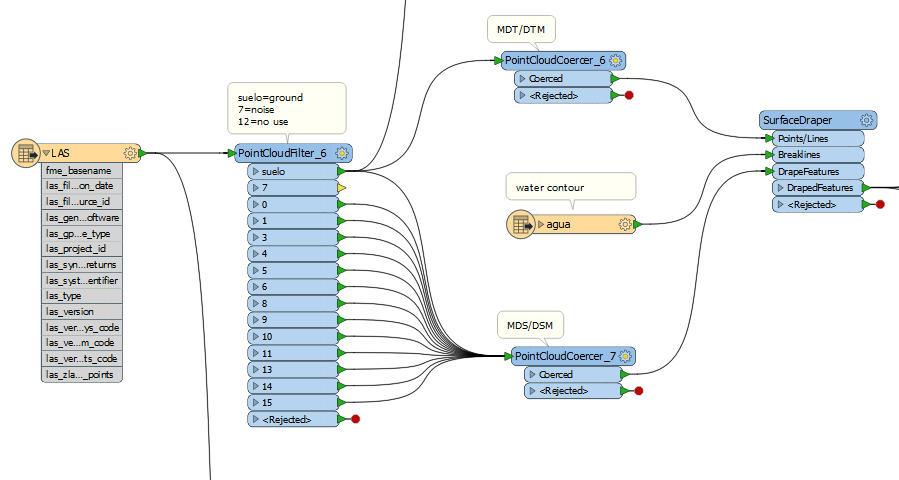
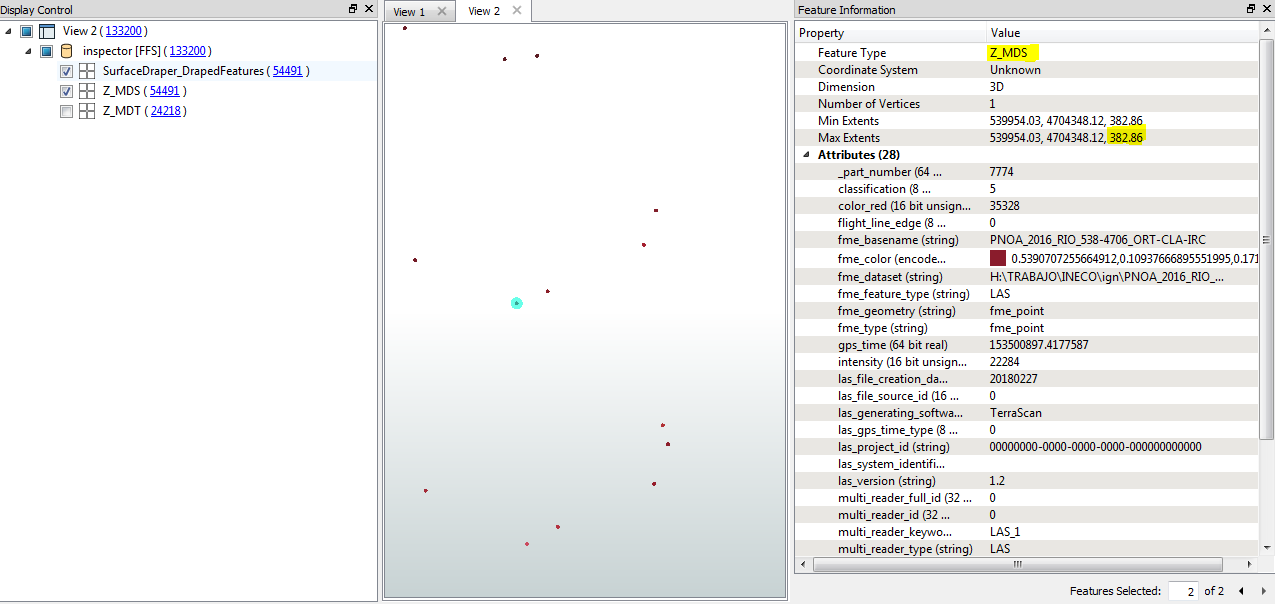
hola, queria saber de la manera mas fácil, como restar de dos ficheros lidar los valores de las Z. Realmente es el mismo lidar, lo que uno es solo con la clasificación 2, el otro con todas las clasificaciones. donde el resultado sea que se represente las alturas o elevaciones de los objetos respecto al suelo. he llegado poder hacer la resta de las Z, pero no he podido cambiar el valor de la Z calculada con la que tiene el punto. ¿como puedo cambiar la geometría de la z vieja con la calculada?

Hello, I wanted to know in the easiest way, how to subtract from two LIDAR files the values of the Z. It is really the same lidar, what one is only with the classification 2, the other with all the classifications. where the result is that the heights or elevations of the objects are represented with respect to the ground, I have come to be able to do the subtraction of the Z, but I have not been able to change the value of the calculated Z with the one that has the point originally. How can I change the geometry of the old z with the calculated one?


5 replies

Userlevel 4
Badge +13
Hello @ftl.


Sharing a few more details will help the FME community help you. Please reply to this thread and provide additional details including:
  • The version of FME you are using, including build number and edition
  • A small sample of your data, or screenshots of the data in the FME Data Inspector
  • A description of your expected output, with screenshots if possible
  • Your FME workspace
  • Your FME translation log file
  • Any other information that may be useful to share
Badge +22

Depending on the format of your data, either a PointCloudExpressionEvaluator or a 3DForcer could work.

Badge +1

Sorry, i could´n answer before. I am thinking the best process to the work. to calculate the diferent, between model digital terrain and model digital surface. First i need a TIN of MDT, and after i need calculate the distance of each point of the lidar to de face of triangle of the TIN. And after generate a LAS file, with the new heigth (the distance vertical, between the surface of triangle of terrain and the point of building or tall vegetation ).

and the result:

the same point in her real position (heigth)

What can I do to create a new Z value with height differences (382.86-378.178=4.682). adn generate a new LAS file.

thanks

Badge +1

pnoa-2016-rio-538-4706-ort-cla-irc.zip reader

Badge +1

las-esrishape2geotiff.fmw dataset

Reply