Solved

Combine, tilling and compress las files without converting rel64 to int32


Badge

hi,

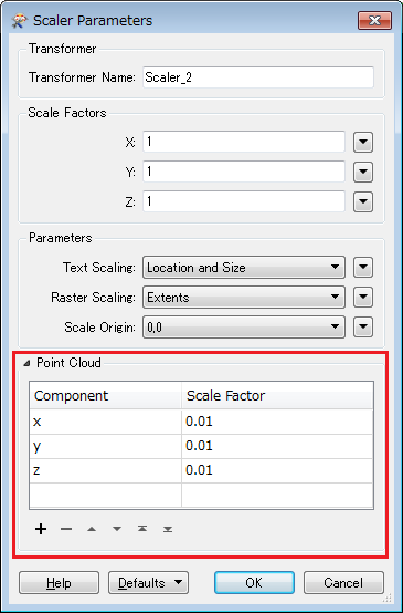
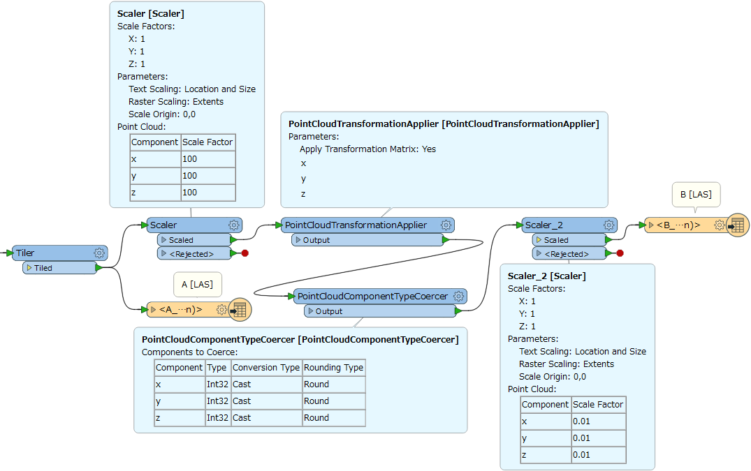
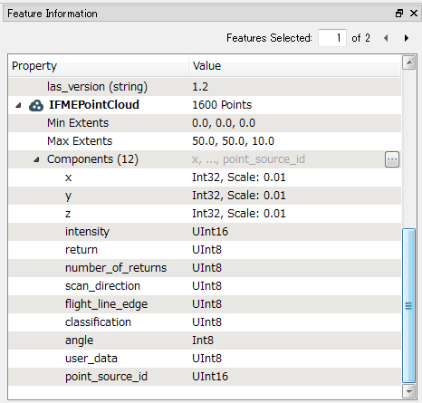
I have a number of lidar files in LAS format. I’m using reading las, then combining them and tiling them, then writing zlas. Everything is OK except that I get a message that there is a value-converting from rel64 to int32. Is-it possible to get the results las files in rel64.

icon

Best answer by takashi 12 July 2017, 15:52

View original

6 replies

Userlevel 2
Badge +17

Hi @miladahmad, according to the Quick Facts on LAS Reader/Writer, the format supports only Int32 type for the x, y, z components, so I don't think the destination zlas dataset can contain Real64 x, y, z. However, the LAS writer seems to calculate and set appropriate scale factors to x, y, z components automatically, in order to represent decimal values with integers.

If the scale factors automatically set are not desired, you can also set your preferable scale factors with some transformers. For example, if the tiled point cloud have Real64 x, y, z without scale factors and you want to use 0.01 (equivalent to two decimal places precision) as the scale factors in the destination zlas dataset, these transformers might help you.

  1. Scaler: Set 100 to scale factors for x, y, z components.
  2. PointCloudTransformationApplier: Apply the scale factors to x, y, z components.
  3. PointCloudComponentTypeCoercer: Cast the data type of x, y, z components to Int32.
  4. Scaler_2: Set 0.01 to scale factors for x, y, z components.

Note that you should set scale factors via the "Point Cloud" section in the Scaler Parameters dialog, like this.

Badge

thanks takashi.. OK, then I should apply all the following : scaler (100), then PointCloudTransformationApplier, then pointCloudCompenentTypeCoercer (example component x, type int32, cast, round), then another scaler for 0.01, then another PointCloudTransformationApplier, then PointCloudCombiner, then tiler.

is that correct?

what is the scale factors to x, y, z by default (which applied by the las fme writer)?

thanks again

Userlevel 2
Badge +17

No, I intend to apply the transformers AFTER tiling and then write the point cloud feature into the destination LAS dataset. The screenshot below illustrates my intention.

See also the attached workspace and compare A and B to find differences between the default scale factors set by the LAS writer automatically and ones modified with the transformers.

set-scale-factor-to-point-cloud-component.fmw (FME 2016.1.3+)


You can see properties of components including data type, scale factor etc. on the Feature Information window of FME Data Inspector. e.g.


Badge

thank you very much..

You can see properties of components including data type, scale factor etc. on the Feature Information window of FME Data Inspector. e.g.


Hey Sir, Do you have any idea on how to segmentize lidar data within FME workbench and making plane fitting using the equation Ax+BY+CZ=0

Reply