
Is there something wrong with the Inspector? Here is the layer(s): http://cmnmaps.ca/mapguide/mapagent/mapagent.fcgi?REQUEST=GETCAPABILITIES&SERVICE;=WMS&VERSION;=1.3.0& The BC Mines Layer works with Gaia but the others don't for some reason. I am using FME desktop 2018 thanks


Userlevel 2
 +17
+17
- Safer
- 1580 replies
-
31 July 2018

Hi @masonb12,
I was able to read four of the layers listed as available in the Data Inspector:
- Common_Data/Mines/Layers/BC_Mines
- Common_Data/Mines/Layers/Historic_Mines
- Southern Gulf Islands/Layers/Parks_gi_shoremod
- WITS/Layers/BAEA_Validated
I tried the same service in ArcGIS Pro as well, and was only able to see results from those four layers. The other layers appeared to load into the map, but no image was shown.
IN FME Workbench, the other layers return an exception that the class does not exist when trying to read them, although a schema was returned for the layer to the GetDescription call.
I would recommend checking with the WMS service provider about the unreadable layers.

 +6
+6
- Contributor
- 19 replies
-
31 July 2018
Thanks Dave, but were you able to actually see any of these 4 WMS layers in the data inspector? FME desktop seems to read them in ok but there is nothing to see in the inspector. thanks
Userlevel 2
+17
- Safer
- 1580 replies
-
31 July 2018
Hi @masonb12,
They were visible if you read them directly in the Data Inspector. If you read them in Workbench then sent to the DI, they were just a blank image - most likely due to the extents requested. DI seems to determine the extents of the data, then request that, while Workbench makes you set the correct extents.
+6
- Contributor
- 19 replies
-
31 July 2018
Hi @masonb12,
They were visible if you read them directly in the Data Inspector. If you read them in Workbench then sent to the DI, they were just a blank image - most likely due to the extents requested. DI seems to determine the extents of the data, then request that, while Workbench makes you set the correct extents.
Userlevel 2
+17
- Safer
- 1580 replies
-
31 July 2018
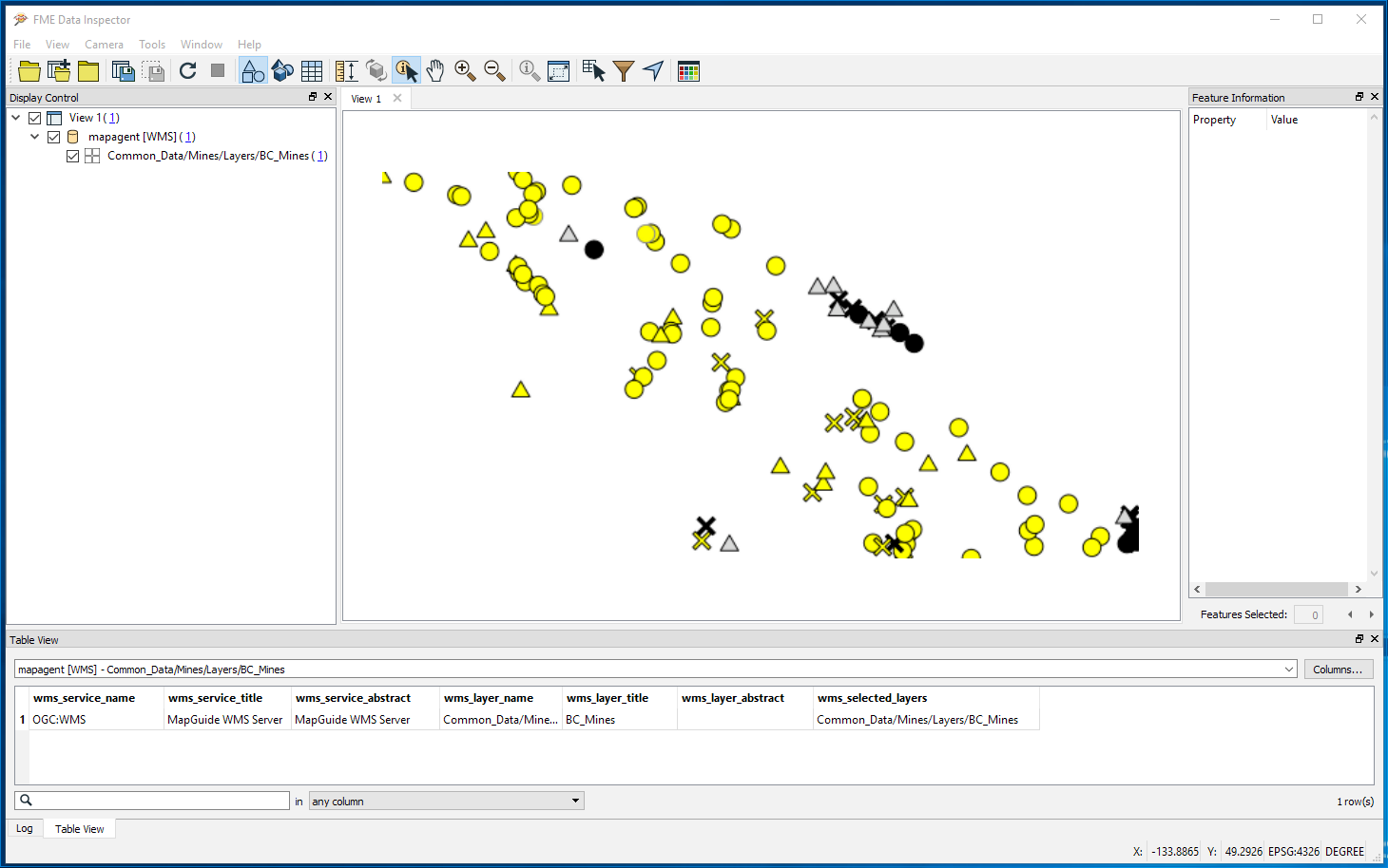
Thanks Dave, when I try to view the wms layers directly in DI all I get is a grid of points. Is there a step that I am missing?
This is what I can see in 2018.1 DI:
Reply
Enter your username or e-mail address. We'll send you an e-mail with instructions to reset your password.