Question

Export to landxml

  • 2 February 2018
  • 6 replies
  • 20 views

Hey

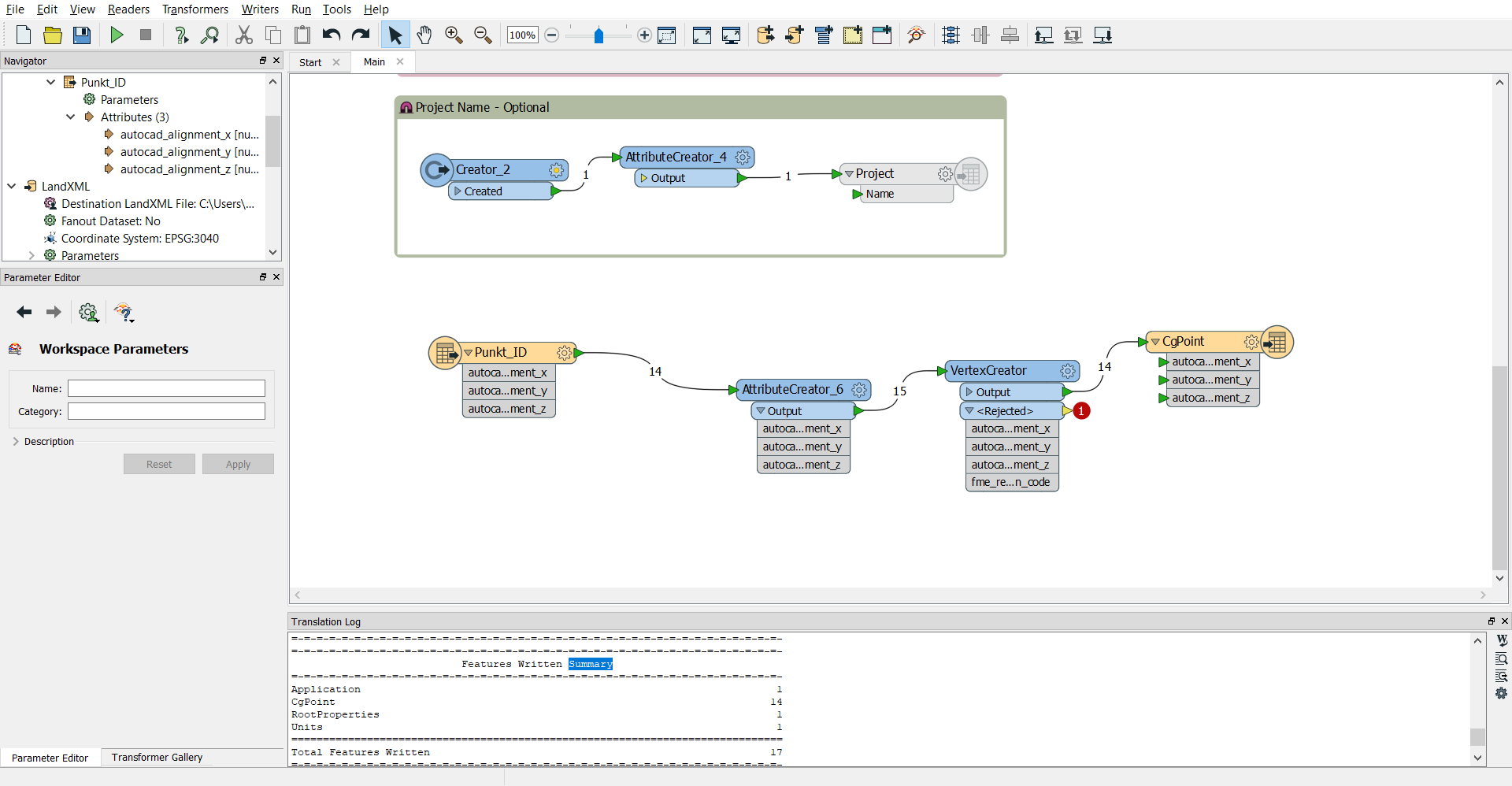
I am curious to know if fme can export to landxml with points, Lines and attributes to the objects ? I am new in the use of FME.

And it could be nice to get some guidelines on how to do it.

I have looked at https://knowledge.safe.com/articles/1203/creating-landxml-files.html but I think it is hard to understand what is going on in the template.

Thanks


6 replies

Badge +16

If I remember correctly it’s been awhile since I have used it, the template shows which xml elements are needed to correctly write a landxml file

It’s a matter of introducing your data to the template and make sure you are creating the necessary xml elements per geometry type.

Hope this helps

but I am not sure how to add my data to the template - maybe you can explain me how to ?

Badge +16

but I am not sure how to add my data to the template - maybe you can explain me how to ?

I suggest you look up some articles about how to write XML with FME to get yourself familiar with the XML Templater and other XML related transformers.


Another tip is to get your hands on a LandXML file that you can use as a template to create the correct XMl tags in the XMLTemplater.


Good luck!


Badge

I have been experimenting with LandXML files for a while now and I must admit that the LandXML reader/writer is not the most easy way to use LandXML in FME.

Just use LandXML as any other XML and use the great XML tools inside FME to work with LandXML.

The template shows writers for RootProperties, Units, Application and Project. That is just the 'metadata' you give with each file. You have to add the actual data (alignments in 2D/3D, topography, point features, etc.) yourself. If you have a specific problem you are stuck with, i'm always happy to help.

jneujens

I have tried to add a writer (Landxml) called "Cgpoint". I want to add point in the landxml. When I click at the bottom "run", the output "landxml" regonize 14 points but there are no coordinate linked to the points. landxml-test-februar.xml

What should I do to get coordinate ?

I want my point output to be like <CgPoint name="L1P1" timeStamp="01-12-2017 09:17:43" oID="L1P1">6188475.6575 553178.1178 34.1251000000048</CgPoint> ?

How should I do that ?

Badge

jneujens

I have tried to add a writer (Landxml) called "Cgpoint". I want to add point in the landxml. When I click at the bottom "run", the output "landxml" regonize 14 points but there are no coordinate linked to the points. landxml-test-februar.xml

What should I do to get coordinate ?

I want my point output to be like <CgPoint name="L1P1" timeStamp="01-12-2017 09:17:43" oID="L1P1">6188475.6575 553178.1178 34.1251000000048</CgPoint> ?

How should I do that ?

Strange, looking at your screenshot I would say that should work. Maybe add your workspace and sample data so I can have a look at it?


Can you try out my example below? It is a really simple example that should work.


testlxml.fmw


Reply