Solved

Offset points on map

  • 21 August 2018
  • 6 replies
  • 37 views

Badge

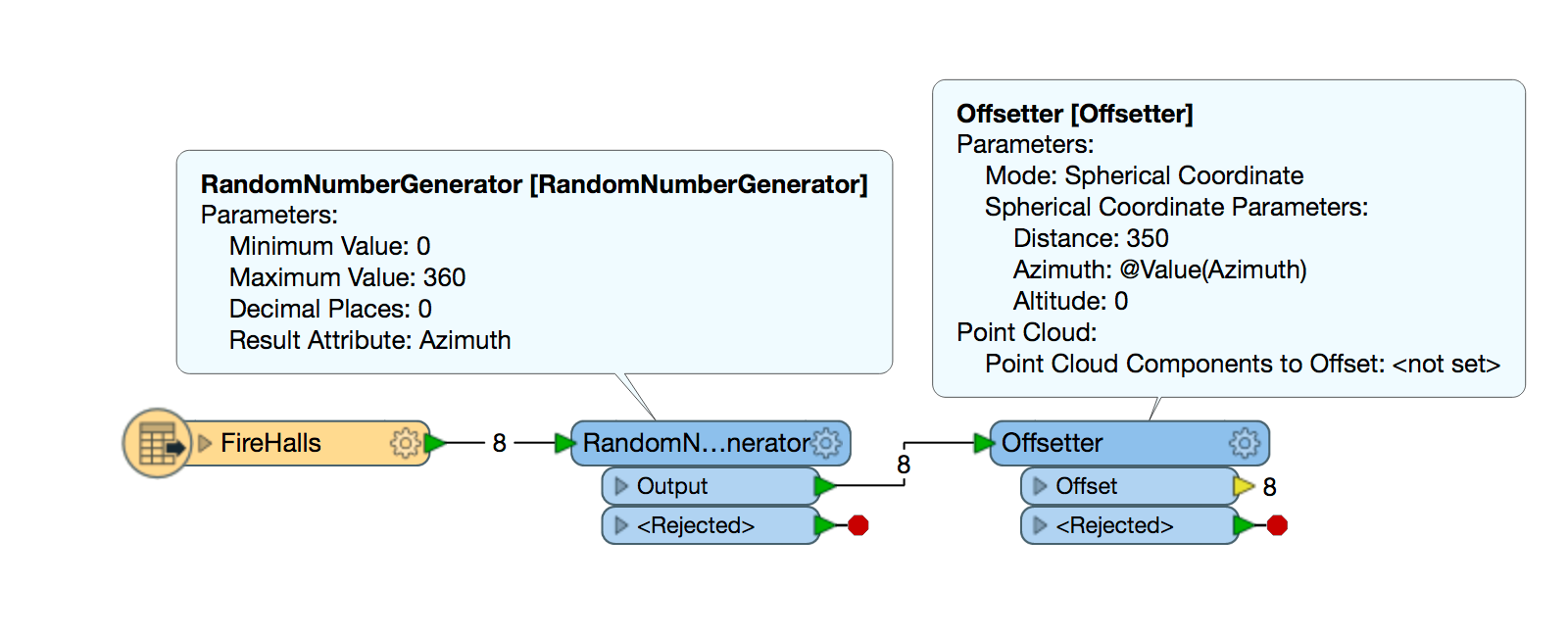
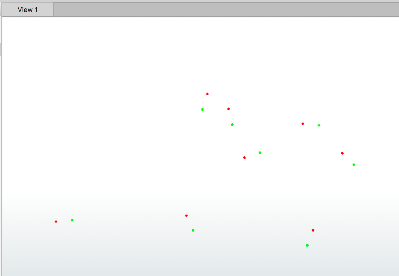
I sShould preface this post with this subject-matter is foreign to me. Seeking solution – with detailed instructions – to offset points on a map. The end application requires lat/long, which I have. I need to take these lat/longs and offset the map points (preferably, in random directions) by 350’.

Thanks in advance!

icon

Best answer by hollyatsafe 21 August 2018, 17:53

View original

6 replies

Badge +2

Hi @keb9113,

You can do this by using the Offsetter transformer using the 'Spherical Coordinate' Mode. There are 3 parameters that require setting here:

Distance - This will follow the coordinate system your points are in, so if it is not in feet then you can either reproject the points or convert 350' to meters.

Azimuth - this is the direction you want the points to be offset in degrees. Since we want the points to be offset in random directions we can use a RandomNumberGenerator to assign each point a random value between 0 and 360 degrees and then in the Offsetter set this new attribute to the Azimuth.

Altitude - Angle in degrees from the XY plane. If you want your points to remain on the ground you can leave this set to 0.

The Workspace should be set up like this:

And you can see in the result in the Data Inspector, here the green points are the start position and the red are the end:

Badge +2

Hi @keb9113,

Sounds like the GeoAnonymizer, available on the FME Hub, is the perfect the Transformer! The GeoAnonymizer takes input features and shifts them in a random direction up to a maximum shift distance which is specified in the parameters.

I've attached a sample workspace where points are created from a CSV file (coordinate system: LL84), using Method 1 described in the Converting from CSV to Spatial Geometry article, and randomly shifted in both distance and direction to a maximum of 350'.

I hope this helps.

- Chris

geoanonymizer.fmwt

Badge

Hi @keb9113,

Sounds like the GeoAnonymizer, available on the FME Hub, is the perfect the Transformer! The GeoAnonymizer takes input features and shifts them in a random direction up to a maximum shift distance which is specified in the parameters.

I've attached a sample workspace where points are created from a CSV file (coordinate system: LL84), using Method 1 described in the Converting from CSV to Spatial Geometry article, and randomly shifted in both distance and direction to a maximum of 350'.

I hope this helps.

- Chris

geoanonymizer.fmwt

Thank you both very much!

Badge

Thank you both for your input. I also need the "new" lat/long points. What am I missing to get this information into an actual field?

Userlevel 1
Badge +10

Thank you both for your input. I also need the "new" lat/long points. What am I missing to get this information into an actual field?

A coordinate extractor will write the coordinates into new attributes


Badge
A coordinate extractor will write the coordinates into new attributes


Got it - thanks!

Reply